Why don’t you tell me about the mystery dance
I want to know about the mystery dance
Why don’t you show me
‘Cause I’ve tried and I’ve tried, and I’m still mystified
I can’t do it anymore and I’m not satisfied – Elvis Costello
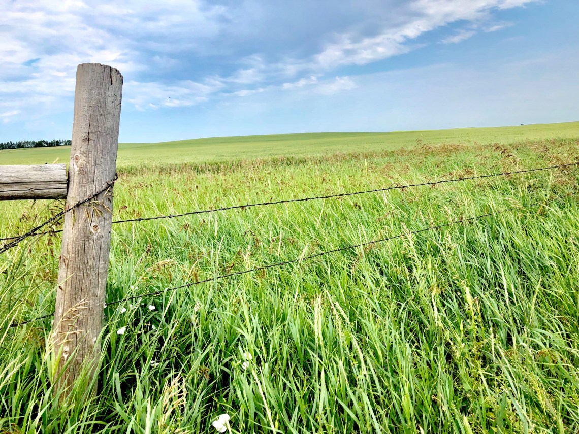
Where North Dakota seamlessly transitions into South Dakota, the landscape continues unvaried. Rendered in muted shades of brown, woven into fields of yellow and green, the great American prairie leads the eye to interruptions in the quilted patterns. A tilted red barn or a glinting silver silo. A white farmhouse, chipped with age, surrounded by knee-high grass. Swallowed by a vast sea of rolling green, quietly inhabited small towns, Buffalo, Redig, Newell, lay on either side of Highway 85. To the east, the open land of Standing Rock and Cheyenne River Reservations. To the south, Tunkan Tipi – the Lakota spirit lodge, remains eternal. A place before plants and animals were brought into existence. A dark, sunken place born before people or bison strode across the earth. An underground world where people waited as the surface of mother earth was being prepared. A place where the earth “breathes inside.”
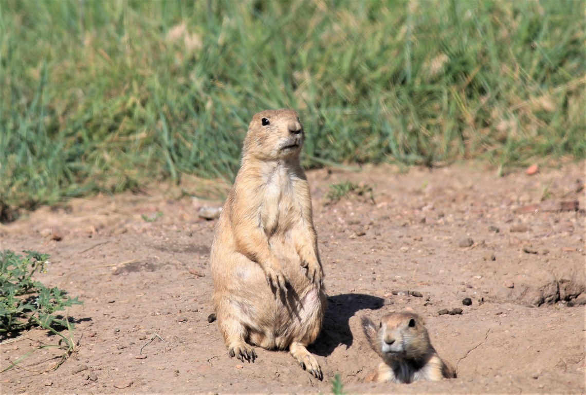
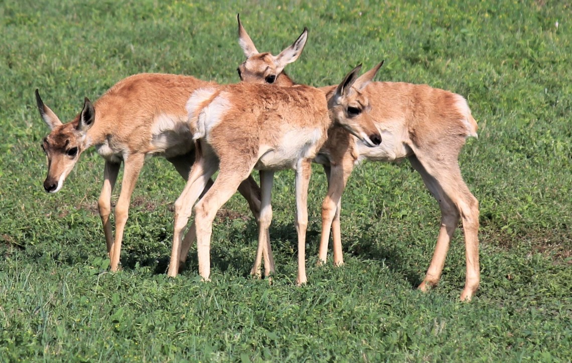
On the boundary between the unending grasses of the western Great Plains and the mighty forests of the Black Hills, Wind Cave National Park leads a dual life. On the surface, purple cornflowers and sego lilies play in tall grass prairies rolling to a line where earth meets sky. Warm winds carry the scent of vanilla and a meadowlark’s song from towering Ponderosa pine, as herds of bison stalk the land, taking what the ground gives before moving on. Pronghorn and mule deer lay in the swaying grasses, patiently waiting for the cool of evening, as elk stealthily roam the forest. Below, lies one of the world’s longest caves, where according to Lakota legend, man first emerged from the earth.
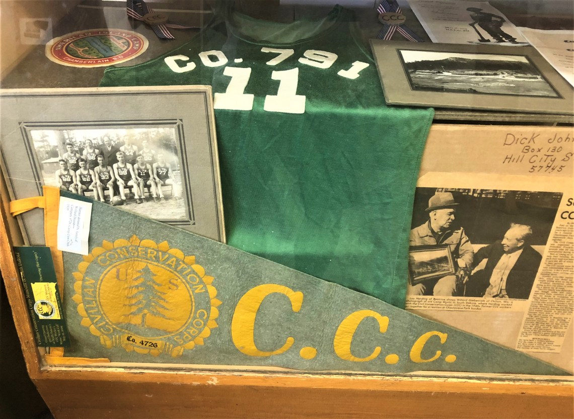
Like Stephen Bishop at Mammoth Cave, 17 year old Alvin McDonald mapped and named many of the rooms in Wind Cave during the early 1890’s. Before he died of Typhoid fever at the tender age of 20, using only a candle and rope as his tools, he systematically explored several miles of its subterranean passageways. He kept a detailed journal in which he described his exploration and subsequent naming of rooms and passageways. Although he became, in his own words, “the chief guide” at Wind Cave, he quickly realized the complexities of the cave and wrote in his journal, “have given up the idea of finding the end of Wind Cave.” Later, during his illness, he wrote, “am homesick for the cave.”
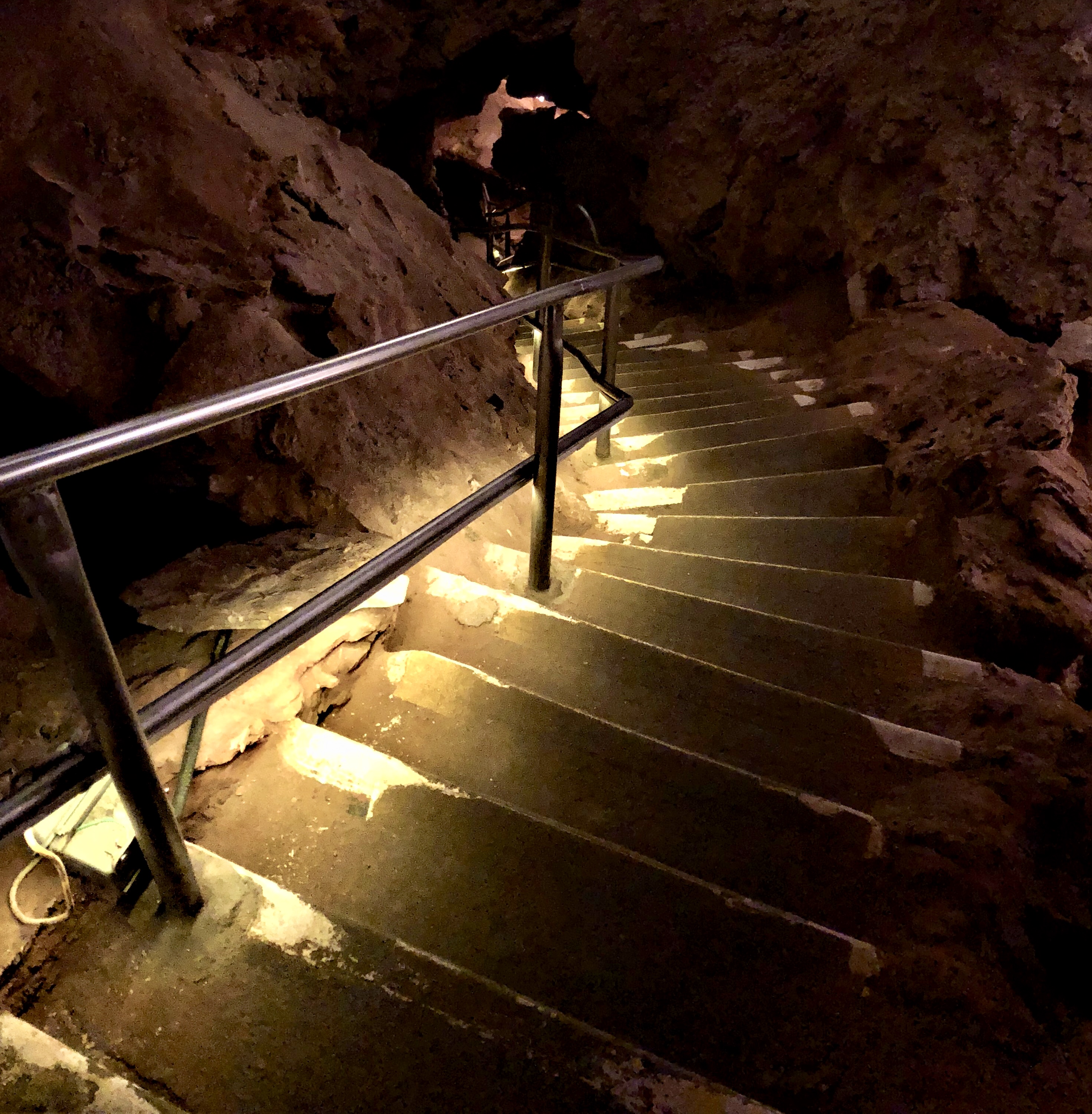
After a short walk along a paved path, bracketed by a slight green slope, our Ranger-led group reaches a wall of stone, with a hole about the size of a basketball. “This is the natural entrance to Wind Cave.” Susan, our Ranger, bends slightly and holds a ribbon of cloth near the top of the hole. Immediately the cloth begins to dance away from the opening. “As you can see, the wind is blowing out of the cave. This is caused by barometric pressure being higher underground than above. It changes with the weather, so on some days, the cloth is pulled into the cave.” With that brief explanation, she turns and leads us to the doorway and the man made entrance to Wind Cave. As usual, I am last in line so I can take photographs.
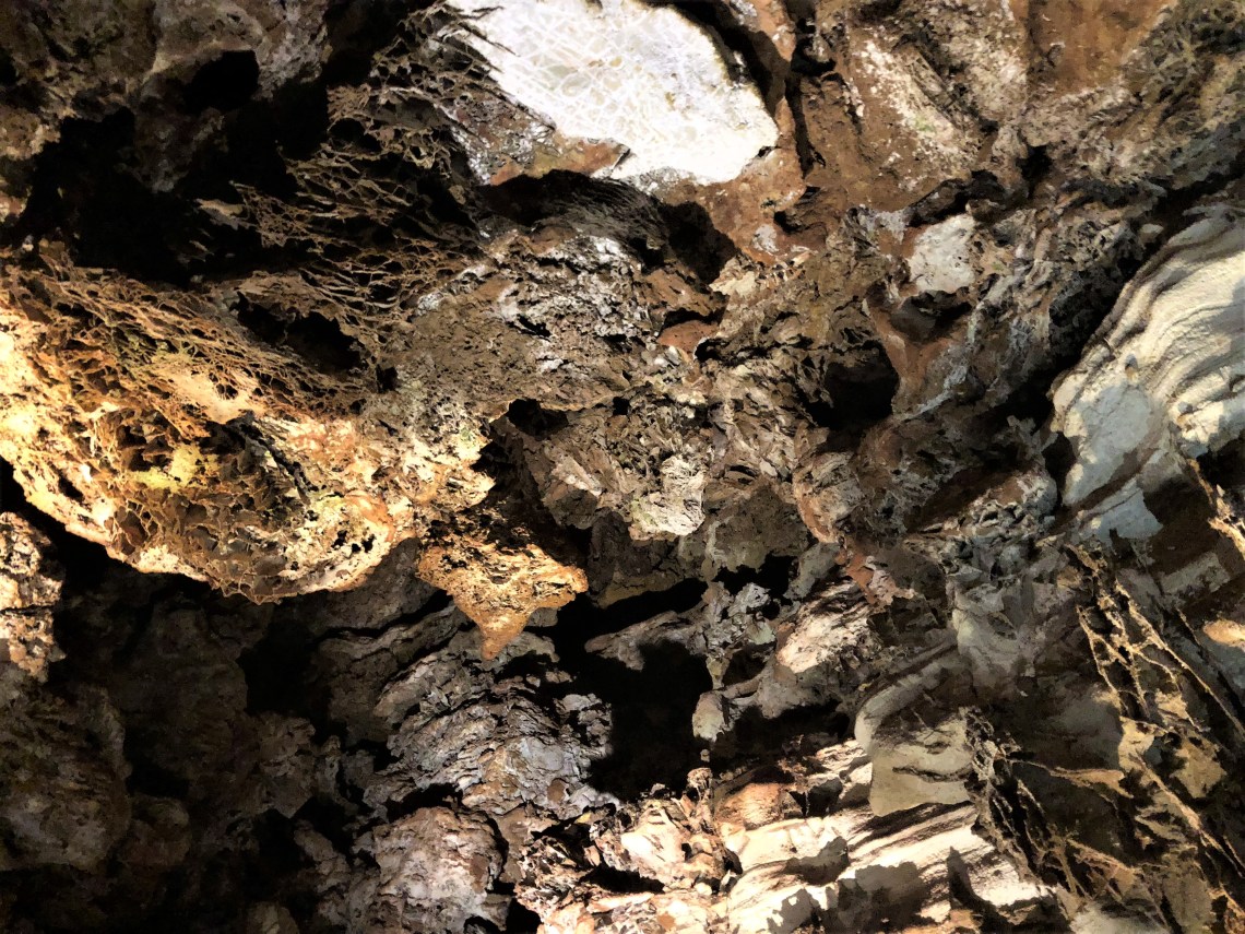
Listed as ‘moderately strenuous’ because of 300 mostly descending steps, the ‘natural entrance’ tour immediately drops between brown rock. Small spotlights provide brief glimpses of traits that make this cave unique. Thin lines of calcite that form honeycomb patterns called boxwork, reach from cave walls, stare down from ceilings. Largely confined to dolomite layers in the middle and lower levels, the calcite ‘fins’ intersect at various angles to form ‘boxes’. This type of patterning, bedrock receding at a quicker pace than calcite, is found in small amounts in other caves around the world. But nowhere else on earth is the boxwork as abundant and well-formed as in Wind Cave. As I walk through this eerie landscape, hundreds of feet below the earth’s surface, I remember lying among the perfect geometric shapes of Badwater Basin, in the Death Valley salt pan. Mother nature’s artistry on display in two very different galleries.


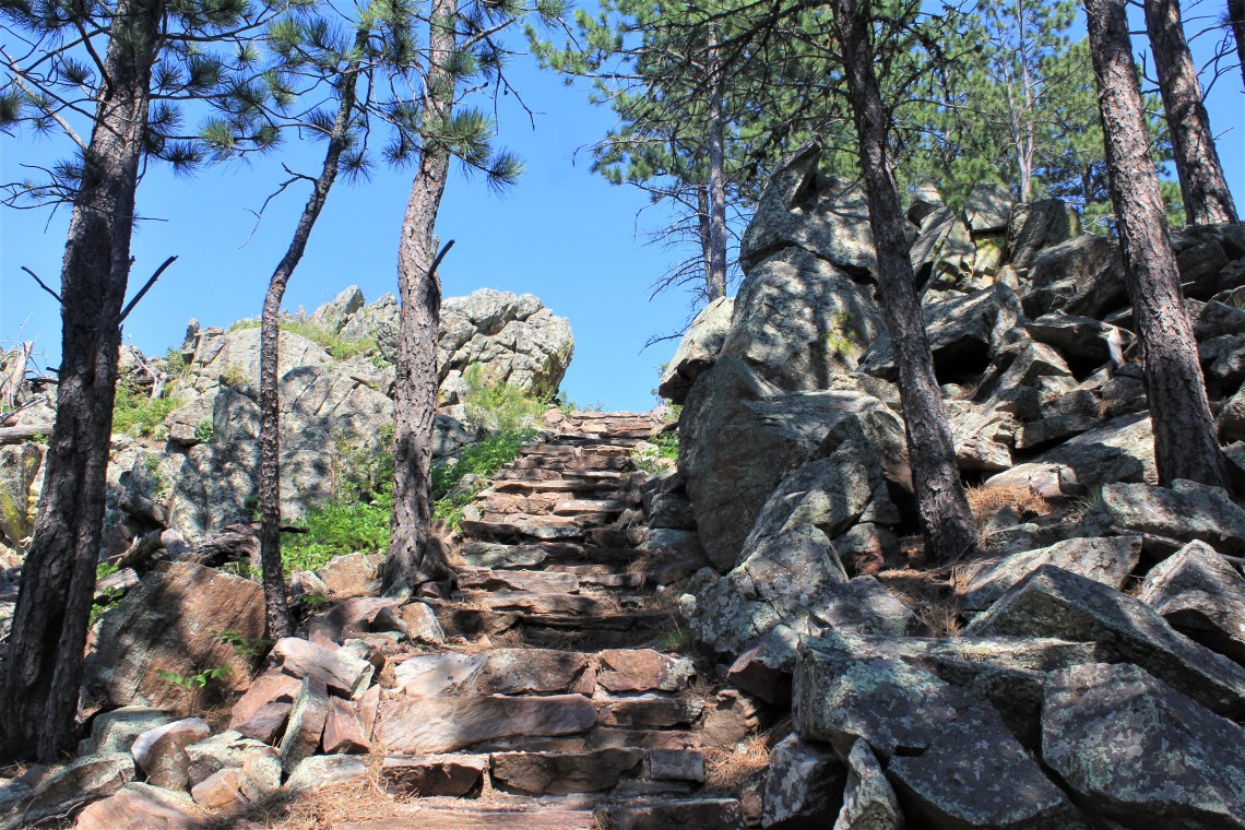
Rankin Ridge forms part of the southeast edge of the Black Hills and at 5,013 feet in elevation, it is the highest point in the park. The single-track trail up the ridge to the firetower at its summit, climbs through ponderosa pine, struggling saplings and wildflowers. Just before gaining the ridgeline, the previously smooth path becomes rocky, eventually leading into a stone staircase which ends at the crest. To the east, now home to longhorned beetles and chickadees, dead trees, ‘snags’, still stand as witnesses to the awful 1994 fire. To the southeast, Buffalo Gap’s break in the foothills is visible against a powder blue sky. Further along the spine of the ridge, I can see where the vast prairies disappear into the Black Hills. Leaning against the base of an unmanned lookout tower, I watch as a herd of buffalo, distant flecks of dark brown, gracefully move through the grass. I listened to the wind rising up through the tall grass before stirring into the unspoiled pines, until a tangerine sun sank in the west.
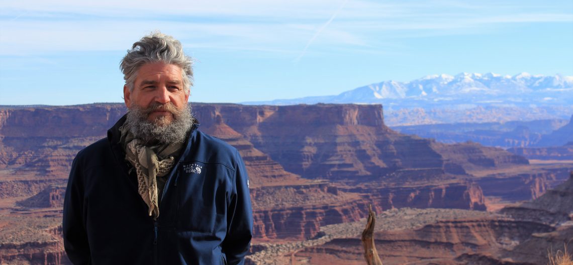
I limped back down to Elk Mountain Campground in the moonless night. Months and months of travel, pretty mediocre food and being alone, were beginning to take a toll. Confronting the loop in my mind was exhausting. On this night, I was ‘bone tired’ as my Kentucky born mother used to say. I stretched out, answerless, hoping sleep would come quickly. It did not. I was awake deep into the night, walking toward Wing Lake in slow motion.

After breakfast in the rain, Highway 87 leads me north through Custer State Park. Surrounded by infinite shades of green, the road winds past the gray rock of Mount Coolidge, Ghost Canyon and Horsely Gultch. The sky is a menacing slate blue as I pull into the old mining town of Keystone, at the doorstep of Mount Rushmore. More than 2 million people visit Washington, Jefferson, Roosevelt and Lincoln each year and virtually all of them pass through Keystone. Work on Mount Rushmore began in 1927, annually employing an average of 25 to 30 men, until its completion in 1941. The first year of completion, almost 400,000 tourists ventured into the Black Hills to see Gutzon Borglum’s masterwork. Keystone soon discovered the power of trinkets and 77 years later I discovered what uninterrupted tourism does to Main Street.
Established as part of the celebration of the United States’ Bicentennial in 1976, the Avenue Of The Flags greets visitors as they approach Mount Rushmore. Alphabetically ordered, fifty-six flags representing fifty states, one district, three territories, and two commonwealths of the United States of America. Rising above this corridor of moving color, above a nearly full amphitheater, bearded in scree and lonely evergreen, 65 foot granite faces gaze out across the landscape. As the sky darkened and slender beams of light were projected onto the granite, it is impossible to not be moved by such a majestic work of art. It represents the power, weight and wisdom of four men, human and certainly flawed, who tried to lead us to our better angels. As Paul Simon and Art Garfunkel once sang, “Where have you gone Joe DiMaggio, our nation turns its lonely eyes to you.”
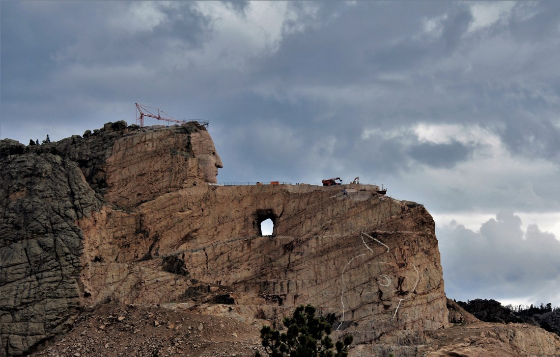
In 1876, Crazy Horse led a band of Lakota warriors against Custer’s Seventh U.S. Cavalry battalion in the Battle of the Little Bighorn, also known as Custer’s Last Stand. Their land stolen, their people divided, Great Plains Indians Chief Joseph of the Nez Perce and Sitting Bull of the Hunkpapa Lakota were forced into submission. For the next year, refusing to surrender, Crazy Horse fled with his people. In 1877, under a flag of truce, ragged and tired, Crazy Horse entered Fort Robinson to negotiate a peace treaty with U. S. Military leaders. When he realized the Army intended to imprison him, he struggled and drew his knife. Fellow warrior, Little Big Man, tried to restrain him, as a military guard lunged with a bayonet and fatally wounded the great warrior. An ignoble death for a fearless, noble man.
In May of 1946, only 16 miles from Mount Rushmore, Chief Henry Standing Bear and sculptor Korczak Ziolkowski, once an apprentice to Gutzon Borglum, chose 600 foot Thunderhead Mountain as the location to carve a likeness of the great warrior. Ziolkowski worked on the project until his death on October 20, 1982, at age 74. “By carving Crazy Horse, if I can give back to the Indian some of his pride and create a means to keep alive his culture and heritage, my life will have been worthwhile.” He is laid to rest in the tomb that he and his sons blasted from a rock outcropping at the base of the mountain. He wrote his own epitaph for the tomb door and cut the letters from steel plate. It reads:
KORCZAK Storyteller in Stone
May His Remains Be Left Unknown