“The heart is the chief feature of a functioning mind.” – Frank Lloyd Wright
As evening settled over swaying grasslands, I opened one of Oliver’s journals. I didn’t know what I was looking for, or why. I’ve only been able to read Oliver’s words in short spurts. His words remind me of his creativity, his love of life – our shared love of painting with words. There are times when I see his words on the page and I feel him beside me, comforting me. I hear his voice and the sound of pencil on paper. Sometimes his words fill me with sadness and pain that is physical and deep. Pain that wordlessly falls into a hollow space. Without warning, at any moment, six years after his death, the pain returns as raw as that sunny day in late May, when I stood above the lake and screamed his name. OLIVER! OLIVER! OLIVER! On this night I couldn’t look at Oliver’s words. I was afraid of what might open in me that I couldn’t close.
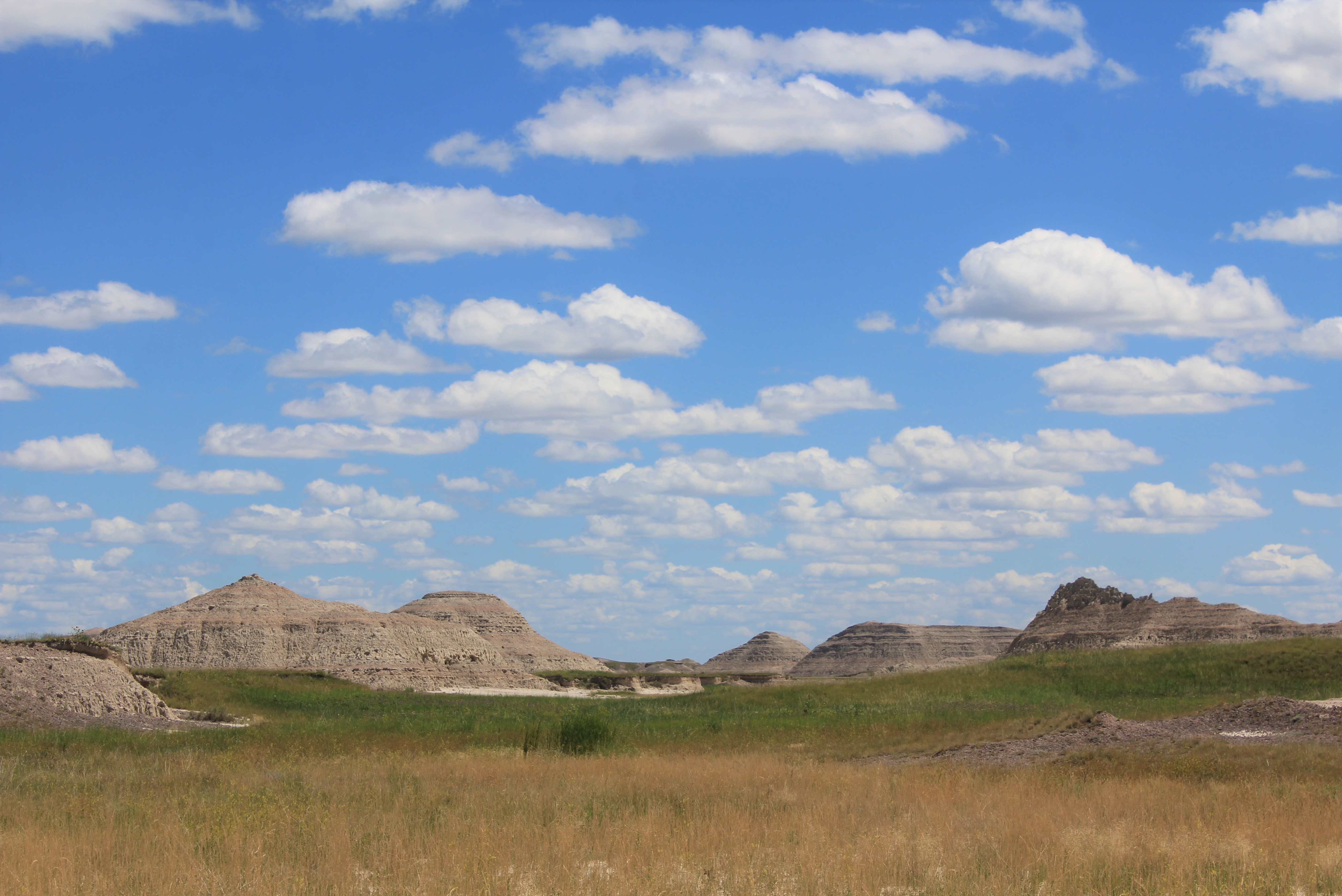
Buffalo Gap, South Dakota, population 126, sits on the eastern fringe of the Black Hills, near the banks of Beaver Creek. Driving north, Highway 79, clings to the western forests, while heat stunted grasses reach eastward as far as I can see. Near Rapid Valley, Highway 44 begins to dip southeast, crossing Rapid Creek and the Cheyenne River. Four miles to the south, after passing through the invisible town of Scenic, Sheep Mountain Table Road veers into the Stronghold Unit of Badlands National Park, which lies within the Pine Ridge Indian Reservation. In the distance, Sheep Mountain lays broadly and unevenly across the horizon, a low slung portrait in beige.
Countless sunflowers line the chalky cindered road before it winds through narrow corridors of layered sedimentary rock, deposited over 25 million years ago. As I rise to the ridgeline, western wheatgrass gracefully sways in the wind. Hundreds of feet below, a green tabled plateau flows into tannish brown Brule Formations. Traced in ivory white, bands of sandstone deposited in channels mark the course of ancient rivers that flowed from the Black Hills. Looking out over this mysteriously textured landscape, white clouds tiptoe into a delicate blue sky above awning striped rock and wind is the only sound.
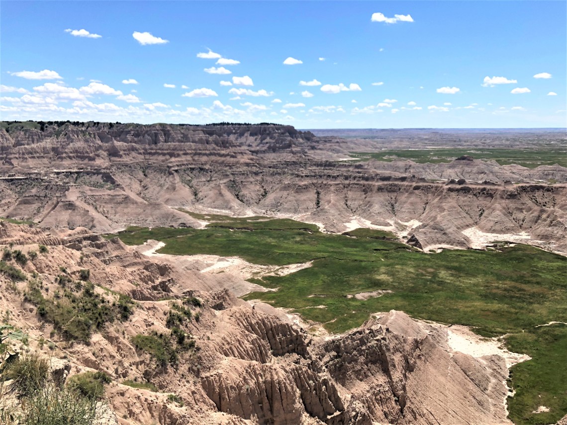

Badlands Loop Road meanders through the North Unit, southeast by northwest for 19 miles, before intersecting with Sage Creek Rim Road and continuing west for another 14 miles. A dozen turnouts, or overlooks, each showcasing geological wonders, dot the two lane road. Big Badlands Overlook gives me my first view of The Wall, where tiered cliffs drop to the lower prairie and cottonwoods hold the banks of White River. Yellow Mounds and Pinnacles Turnouts, look into fractured landscapes of twisted canyons, flattened buttes, razor edged ridges and purple hued hills. Alligator fossils, timelessly locked in Chadron Formations, rest on black Pierre Shale. Volcanic ash forms the bottom of Sharps Formations, marker beds for geological mapping. Badlands Wilderness Overlook gazes into a sea of wild grasses. Needle-and-thread grass, prairie coneflower and white milkwort. Rolling eastward unbroken, one of the largest expanses of mixed-grass prairie in the United States. I stop at each opportunity, trying to capture the shifting colors of an exquisite, harsh landscape.
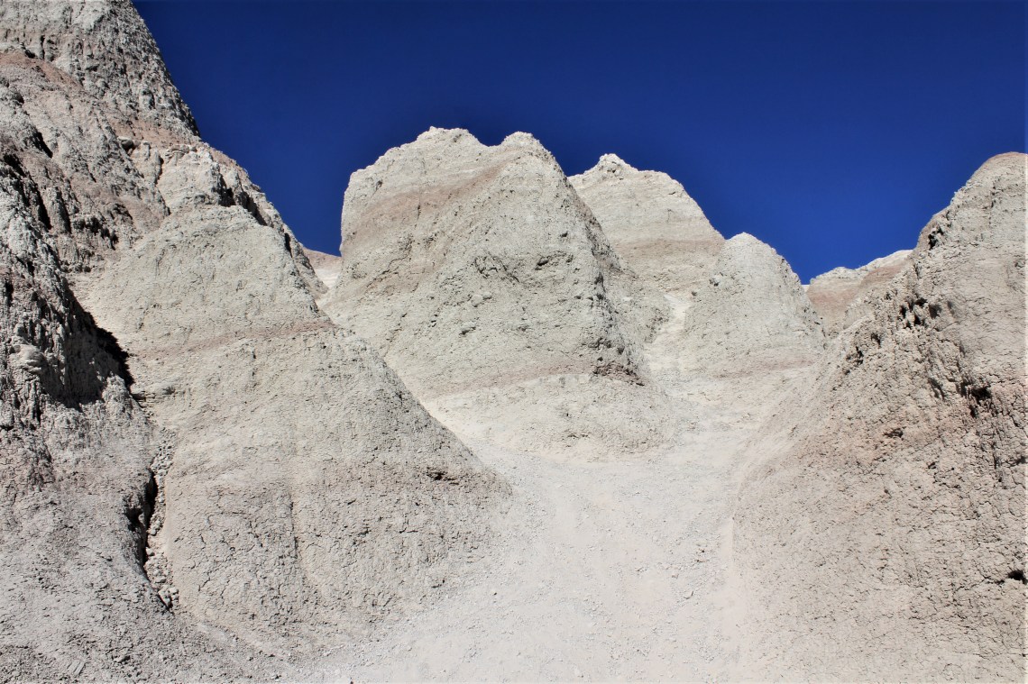
There are only 17.5 miles of marked trails in Badlands National Park, all on the very eastern edge of the park. It’s midday as I pull into the small lot that marks the trailhead of Saddle Pass Trail. Essentially a quarter mile straight up, it’s described in the guidebook as “One of the Badlands’ shorter but more difficult maintained trails in terms of terrain and elevation gain.” The rugged trail follows a steep, unevenly eroded gully between cement colored rock with burnt pink striations, before emerging onto a sweeping bluff atop the Badland Wall. Looking back across the road, the undulating hills of Buffalo Gap National Grassland and the White River Valley, softly stir. A living, breathing earth.
Castle Trail leads east from the summit of Saddle Pass, through a varied landscape of ethereal beauty. Narrow-leaf yucca sits in deep green grass, nature’s mimic of Calder’s ‘Blue Dots in Red Loops Blue.’ As the trail quickly disappears into the hard badlands dirt, I am surrounded by otherworldly shapes. Ahead, isolated in parched, barren soil, a single leafy weed fights toward the sun. I’m hiking among formations and fossils left behind by ancient seas and rivers. Camels, three-toed horses, antelope-like animals, rhinoceroses, deer-like mammals, rabbits, beavers, land turtles and birds. Fossils found in the Pierre Shale include “ammonites, nautiloids, fish, marine reptiles, and turtles.” This is a land marked with secrets held firm.
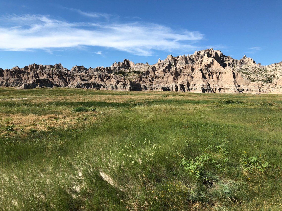
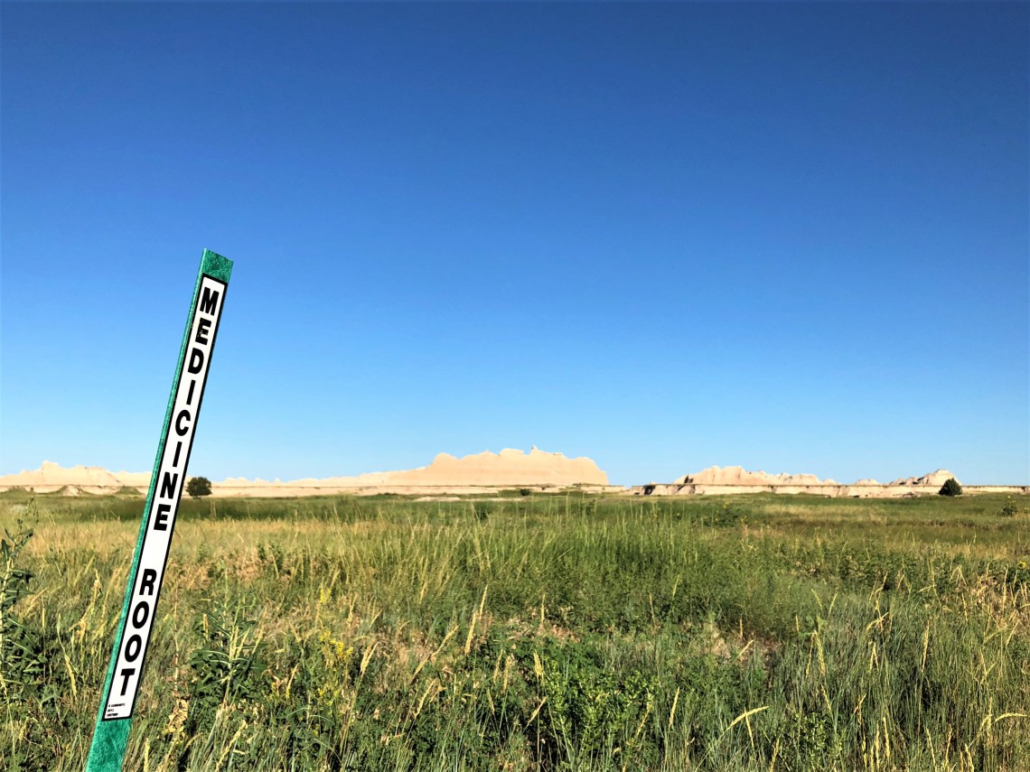
Near the Old Northeast Road, Castle Trail intersects with Medicine Root Trail. Lonely telephone poles line the once used road bed. Even with a detailed map, finding the intersection of the two trails is difficult. I know if I cross the old road I have gone too far east, but there are no markers indicating where the western leading Medicine Root Trail begins. I finally stumble upon a slender ochre track and turn west, wandering into waist high grass. Arcing across a vast level plain, I can see for miles in any direction. Wheat grass plays against my legs, reaching my fingers, as my camera strap snags on clumps of upright prairie coneflower. Grass swishing against my body translates into an ominous hiss. It is unsettling walking for long distances in tall grass, where you can’t see the trail. When the trail finally breaks into the open and crosses a broad field of rocks orphaned by receding rivers, I am relieved. Thirty minutes later I am descending Saddle Pass.
Sage Creek Basin Campground is on the far western edge of the park’s North Unit, near Badlands Wilderness Area. Accessed by an unpaved road that closes after a heavy spring rain, the area is a simple circle of hard ground, surrounded by low grass, shreds of towering spires and yellow mounds. Wind funnels through the various formations and pours across open ground. It is constant, blocking out all other sound. On the paremitter of camp, against a backdrop hoary rock, a solitary buffalo, massive head held steady, strides toward the pale blue horizon.
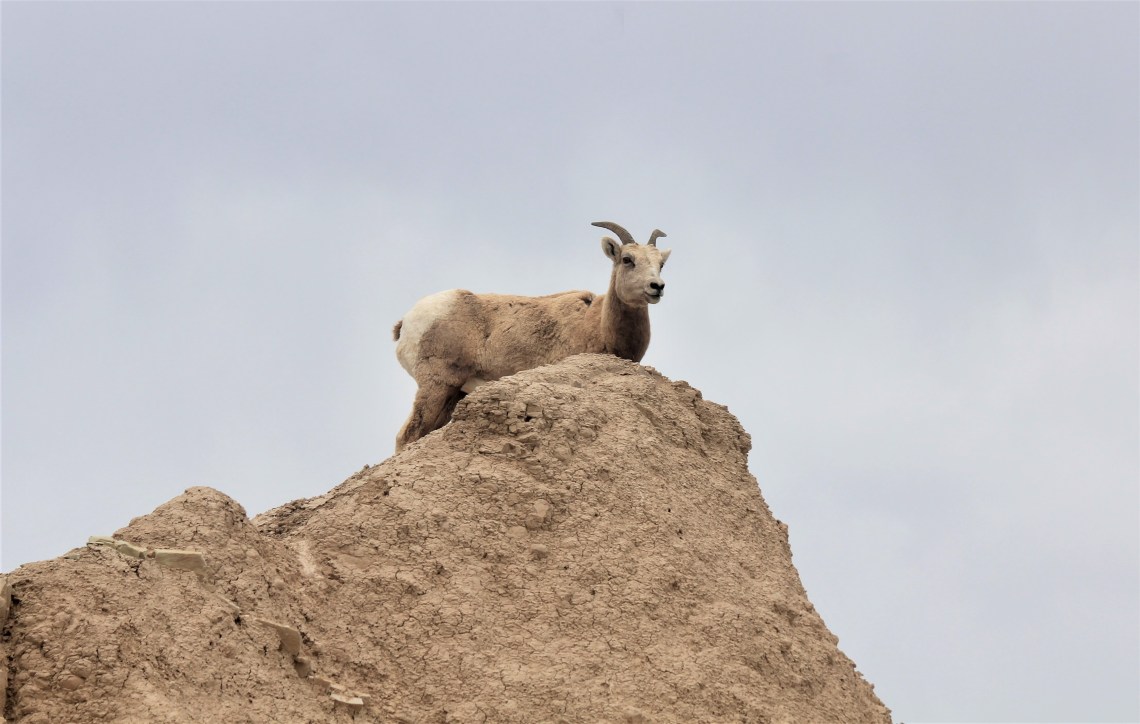
The following morning, I reversed my course and head southeast along the roads I traveled yesterday. My plan was to spend another full day in the Badlands before heading to St. Louis. It also bothered me that I had driven virtually every back road and had yet to see a bighorn sheep. According to the United States Geological Survey website, “Similar to bison, bighorn sheep are native to the area but populations declined significantly due to hunting during westward expansion. The species was successfully re-introduced to the park in the 1960s. The park is concerned about how water and forage availability might change as the climate changes, and what this would mean for grazers like bighorn sheep.” What I read in that statement was, ‘re-introduced in the 1960’s and I still haven’t seen one.’
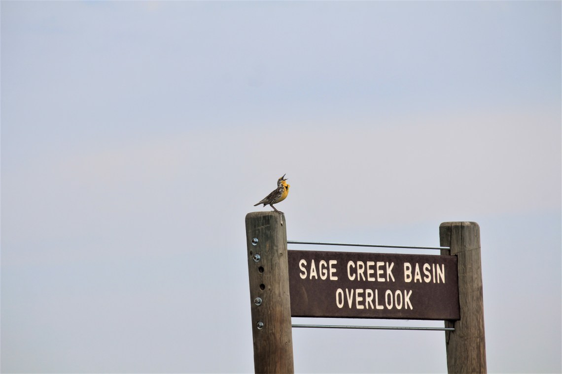
After a short hike into the lumpy ground of Roberts Prairie Dog Town, a horned lark kicking through the dirt, I drove south along Sage Creek Road. It was a glorious day of backdropped blue. To my right, across Sage Creek, Badlands Wilderness Area stretched beyond the Middle and South Fork of the distant Cheyenne River. On my left, the mighty wall and grasslands beyond. After passing Highway 240, which leads razor straight north to the infamous town of Wall, South Dakota, home of Wall Drug and an imposing 40 foot dinosaur, I stopped at Ancient Hunters Overlook. Grassy bluffs slope down into open plains. A majestic ferruginous hawk drifts on the wind, her black tipped wings motionless. Elegantly patterned, I watched as she effortlessly climbed the wind.
As I approached Conata Basin Overlook, something high on a formation caught my eye. Movement. I pulled off the road and walked back about a hundred yards. I scan the tortilla colored rocks and see nothing. Then, in a blink, an adult ewe scrambles to the peak of a rock formation directly above me. She looks down at me, perhaps fifty feet below. I am of no interest to her and in an instant she is gone. I walk around the curve in the road so that the splay of rock is directly in front of me. On a precipitous ridge, a mother and seven lambs. I watch as they scramble over crags and down impossibly steep descents on slippery rock. The mother is graceful, protective. Nudging a lamb forward before resting in a swale, as her lambs play above. A single lamb leaves the group and comes to rest by her mother, on a small splotch of green. In time, as a family they moved to other formations, crossing impassible spires and angles. For an entire afternoon I followed the protective mother and her children. Watched as their concave hooves allowed them to traverse the impossible. I watched for hours as they explored their home.
Tomorrow is the beginning of a two-day, 900 mile drive to St. Louis, so I drove into Wall and parked next to an all-night truck stop, already full of RV’s. My road east, Interstate 90, was a block away. As the day faded and another moonless night descended, I opened my notebook and read words I had written many years ago when I wasn’t a child, but didn’t know how to be a man. I wanted to search my words to see if they provided an insight into the man I had become. To see if they gave me any comfort. To see if they could hold me during the dark night.