I watched you suffer a dull aching pain
Now you’ve decided just to show me the same
No sweeping exits or offstage lines
Can make me feel bitter or treat you unkind
Wild horses couldn’t drag me away
Wild, wild horses, couldn’t drag me away – Mick Jagger / Keith Richards
Tracing Soda Butte Creek northward into Montana on Highway 212, I left Yellowstone National Park as an afternoon sun slid across the sky, shadowing Lamar Valley and the great yellow canyons to the west. Four miles east, Cooke City sits at the western doorstep of Beartooth Highway, the most scenic high elevation stretch of highway in the United States. A 67 mile odyssey among the Absaroka and Beartooth Mountains, the slender road eventually rises to an astounding 10,947 feet above sea level. As I pass Crazy Creek and the junction that leads Chief Joseph Highway south toward Cody, clumps of juniper, cinquefoil and Douglas fir pose at the fringe of the forest, sagebrush scattered at their feet. Grasses and forbs lay across mountain meadows. Smooth white aspen, trunks birthmarked in black, form an oasis in the sub-alpine meadows. Stopping to photograph Index Peak, their gently scalloped leaves move in the wind, a million voices joined in a light green serenade.
Climbing to Beartooth Pass, each cut into rock embraces a sheer drop, every turn creating a Bierstadt canvas. Above 9,500 feet, trees struggle to survive. Cruel winter winds carrying ice pellets and soil particles, disfiguring the few that manage to survive. Krummholz, or “crooked wood” is a German term given to the stunted trees found at high elevations. Elegant in their disfigurement, they stand bent and one sided, backs to the wind. With promises to return, white arms gently wrapped around their greying trunks, winter’s snow patiently waits for an unforgiving angle of summer sun.
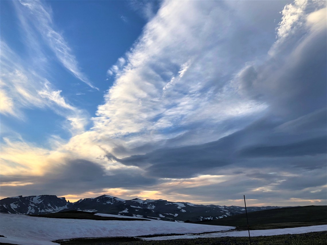
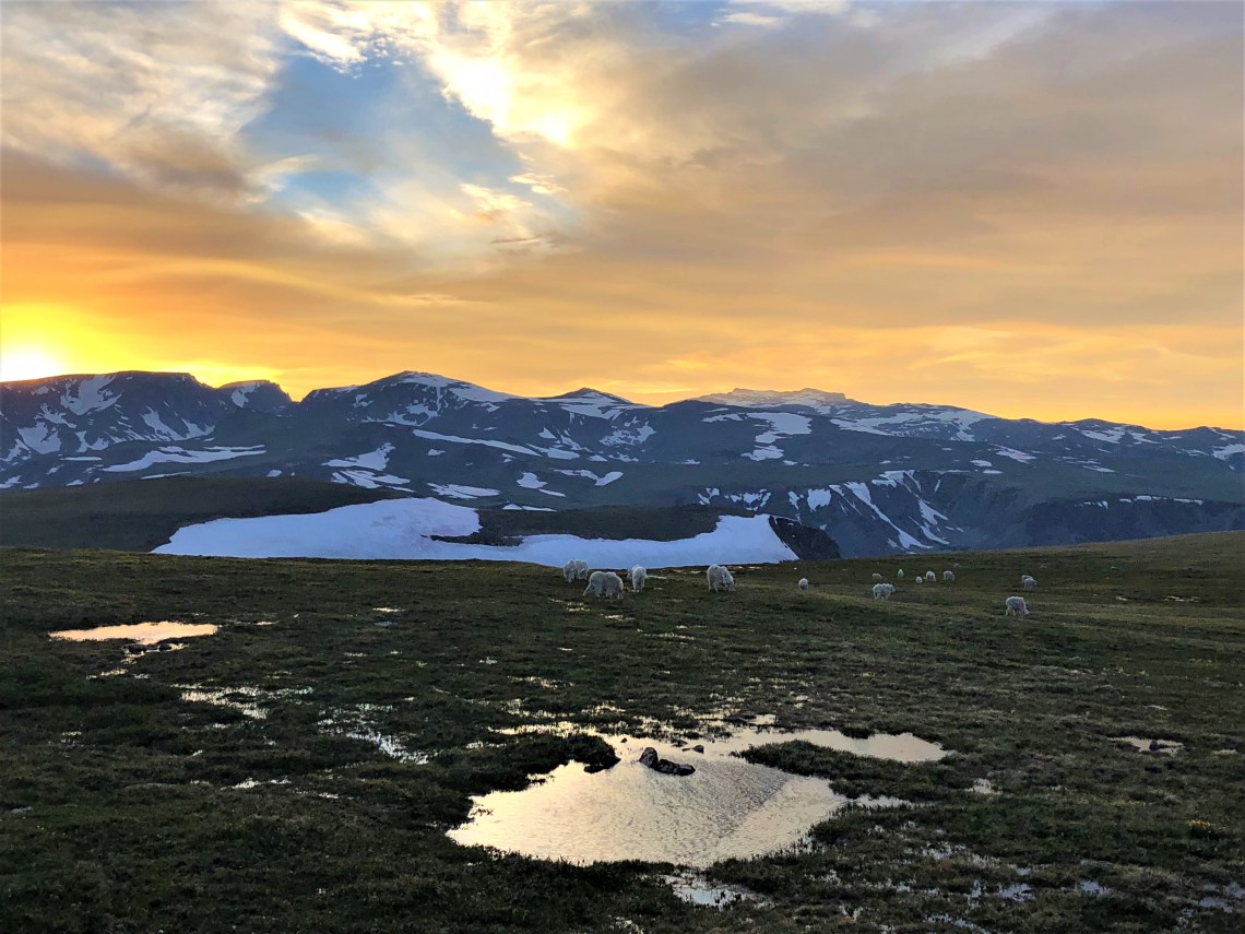
On an edge of the Absaroka-Beartooth Wilderness, at an elevation of 9,518 feet, Island Lake nestles into the Beartooth Plateau. Below a snow blotched shoulder of granite, the thin lake ripples an iridescent blue, the color of scales from an exotic fish. In the distance, jagged blue peaks meet an early evening sky layered in rose. As I walk across the daisy dotted, rocky ground above the lake, I am immediately hit with a cold wind. After several days of heat, even as I shiver, the cool feels good. Staring across the palomino landscape, I can’t help thinking about a family snowball fight from eighteen years earlier. We stood at this very spot. When we were intact.
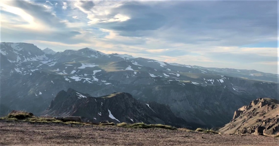
Breaching the summit at 10,947 feet, the broad expanse of the Beartooth Plateau and
surrounding mountain peaks sweep across the horizon. Standing next to a sign marking the highest point on the Beartooth Highway, the scope and majesty of the tundra look and feel surreal. Named “Na Piet Say,” meaning “the bear’s tooth,” by the Crow Indians, a curved pyramidal spire carved by glaciers, sits against a backdrop of low flung clouds. To the southwest, the Absaroka Range reaches toward heaven, a row of volcanic peaks abandoned by ice millions of years ago. To the north, made of 4 billion year old precambrian granite, the broken teeth of the Beartooth Mountains stand among the oldest rocks in the world. In that moment, it dawns on me that I am walking along a piece of ground that witnessed the creation of life on Earth.
As the road reaches back to itself, a lonely chairlift marks Beartooth Basin. Dozens of mountain goats graze the thin hardscrabble grass. Small and round against a spreading orange sky, their thick ragged coats shift in the wind. Amazingly, not more than a hundred yards further, newlyweds stand at the road’s edge, smiling into a photographer’s lens. A cold breeze pushes the bride’s delicate white veil forward. I watch as her husband finds the bottom of the veil and softly lifts it back into place. I see love in her smile as this happens. I wave and shout congratulations into the wind. Both wave back.
Crossing the 45th parallel, halfway between the North Pole and the equator, the road turns north, returning to Montana. Hellroaring Plateau, etched by glacial canyons, sprinkled with lakes of lustrous blue, sits beneath a coat of pinkish snow. A thousand feet below, near Vista Point and Rock Creek Canyon, as dusk settles over the day, seven miles of descending switchbacks begin. Only inches from weeping walls, the road winds down, glaciers appearing at one turn before disappearing around the next, replaced by sweeping tundra or sun glinted mountains. A thin line of asphalt slinks through the dying light, as water soundlessly tumbles through Upper Rock Creek below. Miles in the distance, a single set of headlights rise up from the opposite direction, like fireflies climbing on the wind.
When I pulled up in front of Bogart’s Restaurant in Red Lodge, Montana, my nerves were still jangling with excitement. It had taken four hours to drive 67 miles. I was visually spent. Inside, every stool along a dark wooden bar was filled. Photographs of Humphrey Bogart hung on exposed brick walls. Metal lamps hung above wooden booths. I sat at a small table underneath Humphrey’s gaze and ordered fried pickles and an unsweetened iced tea. My waitress, Meg, asked if I had just come across Beartooth Highway. I nodded. “In that case,” she said “you deserve a beer.” I laughed, ordered a Modelo Especial and settled in. Theodore Roosevelt National Park was another five hours east and I wasn’t going to make it this evening. After pickles and a couple of fish tacos, I spent the night a few miles outside Red Lodge, on the side of an old logging road.
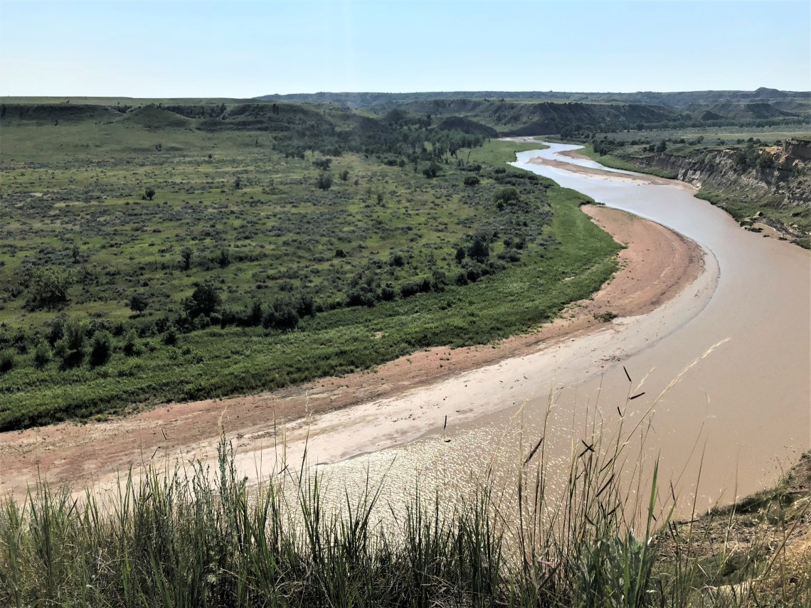
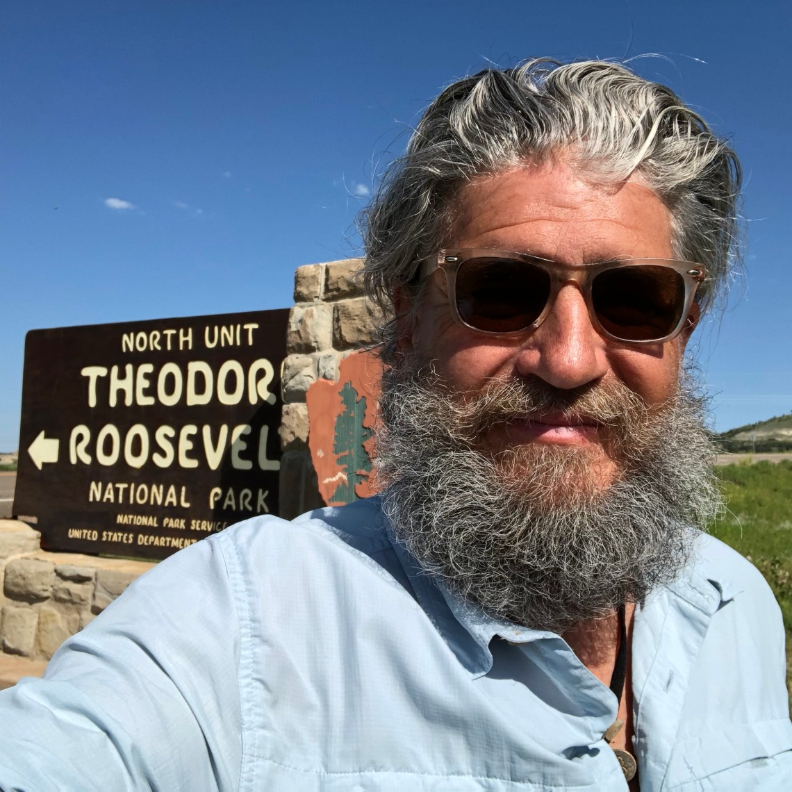
There is no easy way to get from Billings, Montana to Watford City, North Dakota. Clipping the southeast corner of Montana, I-94 threads along the Yellowstone River, across diminishing mountains that slowly give way to rust colored flatlands above the Crow and Northern Cheyenne Indian Reservations. Below Sidney, Route 16 jogs east across the North Dakota border, leaving the Yellowstone behind only a few miles from where it marries the Missouri. Split into two distinct parks, 68 miles apart, the North Unit entrance to Theodore Roosevelt National Park is 15 miles south of Watford City via Highway 85. I arrived around 10:00 AM, found the visitor center and mapped out a few good hikes.
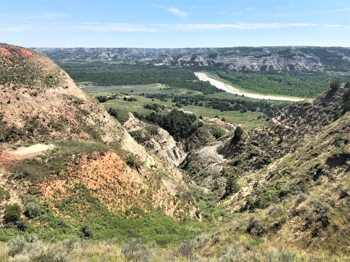
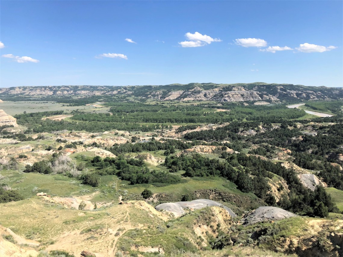
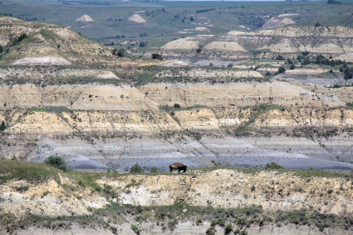
As I’ve done in so many parks, I drove the length of the park – in this case a short 14 miles – stopping along the way to get a feel for the terrain. To see what I was up against. What I could explore. After months of hiking in soaring mountains and lush forests, the dry sedimentary layers of the Northern Great Plains seem foreign and lunar. My eyes, accustomed to great heights rising in the distance, look across endless space. Interrupted only by the wandering Little Missouri River and the Achenbach Hills to the south, miles of blue-gray clay, rippled with seams of lignite coal, weave among low grassy plateaus. Dome shaped hills, lacerated cliffs and steep gullies mark this austere landscape – these beautiful badlands that helped define the life of our 26th President.
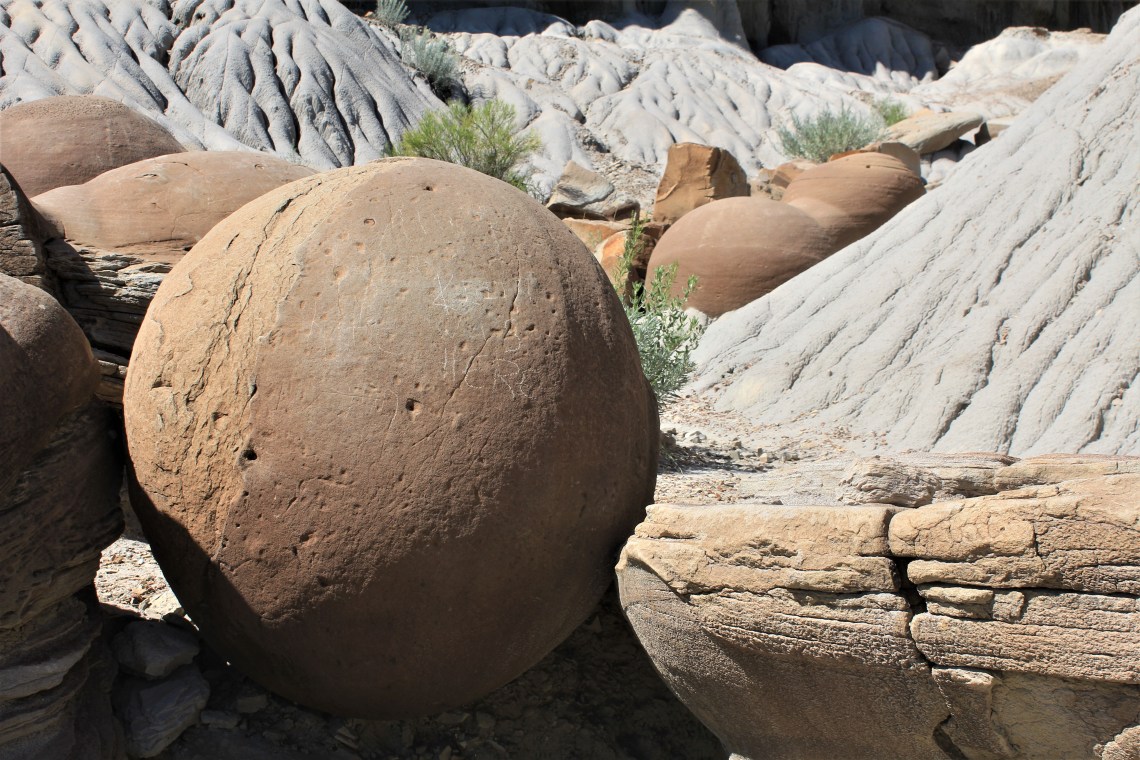
The sun was directly overhead when I parked at the Cannonball Concretions Pullout. As I stepped from the van, with temperatures pushing 90 degrees, heat fell on me like a wool blanket. Perfect. I love hiking in the heat. The hotter the better. I grabbed my gear, made sure I had two full water bottles and set off into the chalky, dry wild.
Formed by the precipitation of mineral cement within the spaces between particles, sandstone spheres, perfectly round, thousands of years in the making, lay scattered across the ground. Seemingly dropped from the sky, the handiwork of a heavenly prankster, they are at odds with all that surrounds them. Bocci balls on a baseball field.
For 1.6 miles, Buckhorn Trail traverses small ravines and grassy prairie, before crossing Squaw Creek and meeting the 4.1 mile loop of Caprock Coulee Trail. The initial 0.8 mile is devoted to a nature trail. Small markers explain the landscape’s myriad features. Vertical piping along coulee walls, caused by burrowing water. Differential erosion creating thin layers of rust-red rock. North facing slopes offer shade for Rocky Mountain juniper. Green ash provides shaded branches for nesting songbirds and scratching posts for bison. Flowing bentonite and light colored pieces of petrified wood scatter across a far slope. Geological traits, coulees and badland slopes, as well as the diverse plant life, chokeberry, silver sagebrush and rabbitbrush, are all found within this mosaic one mile stretch.
Turning west and leaving the brief shade of green ash, the trail climbs to a series of narrow ridgelines. Western wheatgrass sways in the hot breeze. In the distance, banded hills sit rounded by time, colors dulled by the sun. A lone buffalo, dark against sandstone, effortlessly bends to graze. Ahead the trail turns and climbs to the River Bend Overlook, built in 1937 by the Civilian Conservation Corps above the Little Missouri River. I sat in the shade of the stone building and gazed down into the deep recesses of the Little Missouri Valley and the jumbled badlands beyond, stretching west until the blue of earth and sky form a thin line on the horizon. I closed my eyes and took a short nap. You would have done the same.
Before rejoining the Buckhorn Trail, 1.4 miles of steep, barren sandstone and one rattlesnake lay ahead. As I walk, heat comes up from the ground and pools around my dusty legs, my sweat soaked body. In front of me, beige caprock formations, mushrooms of stone, rest on gritty orange laced rock. Walls of sandstone with round holes send the trail scurrying in a different direction. To my right, the gaping valley and a pallet of color. A few feet to my left, a prairie rattlesnake lounging in the afternoon sun. For a moment I freeze. He twitches and I take off like a bat out of hell. When I looked back he was gone. For the next hour my eyes never leave the ground. Aberrations of Freud, Churchill, Monroe and Tuchman waving $100 dollar bills could have danced across the path. My eyes would have remained on the ground.
Beneath tall stands of cottonwood trees, Juniper Campground hugs the Little Missouri River, creator of the badlands. As the day begins to fade and the sun retreats into the wilderness, the air starts to cool. Wild turkeys puff and gurgle, strutting through the fringed sagebrush in a crooked line, as the last of the white cottonwood seeds drift to the ground. Lying on the brown earth they twinkle in the dying sun. I fry a couple of eggs, clean up and snuggle into bed. As the muddy water whispers a nocturnal lullaby, a song of love gently cradles me in sleep.
Home, is where I want to be
But I guess I’m already there
I come home, she lifted up her wings
I guess that this must be the place
I can’t tell one from the other
I find you, or you find me?
There was a time before we were born
If someone asks, this is where I’ll be, where I’ll be oh!
I rise with the sun and dip my toes in the river before finding Highway 85. Seventy miles to the south, across the Little Missouri National Grassland, lies the South Unit of the park. In the east, the sky holds onto fading shades of red. I have the windows rolled down and warm air fills the van. Broken only by wooden posts, unending fields of rolling green, reach beyond solitary barns. Elvis Costello is on the radio and I’m back in school.
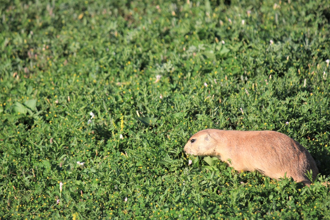
After checking in at Cottonwood Campground to make sure I had a spot for the next two nights, I began driving the 36 mile scenic loop that circles the park. Heading north the road follows the Little Missouri past lumpy fields of countless prairie dogs darting in and out of small volcano shaped holes. A field of perpetual motion, many pose, then duck away in herky-jerky fashion. Others peek from their hiding place, showing only eyes and nose. Up the road, Peaceful Valley Ranch is the only original ranch house remaining in the South Unit. Eldridge Paddock, who shot wild game and sold it to the railroad, built the original 14′ x 16′ cabin in 1913, the same year Teddy Roosevelt first arrived. Behind the ranch, a short trail broken by the CCC in the 1930’s runs into the valley of the Missouri River. Rounding a corner I spooked a pair of white-tailed deer. To be honest, I’m not sure who spooked who. It may take a few more days to fully understand that I’m not hiking in grizzly country anymore.
Coal Vein Trail sits at the end of an unpaved road in the southwest corner of the park. The empty unpaved lot throws up curtains of dust as I pull in. The terrain screams rattlesnakes. A small box asking for a donation holds a stack of trail guides. I’ve seen a lot of these boxes over the past year and always drop in a buck. The guide is sturdy, printed in color on thick paper. On the cover is a list of “things to be aware of.” Cliff edges, stairs, wildlife, poison ivy and snakes. As I walk toward toward rocks striped in muted colors, I’m asking myself two questions. Do the snakes know I’m here? Exactly what are dangerous steps?
In 1951, an underground 12-foot thick coal vein caught fire in a lightning storm and burned for 26 years. Everything above the fire collapsed, forming a deep depression. Stairs were built to rise to the original level of the land. They are very steep (hence dangerous) and over the years a path bypassing the steps has been carved out. I walk up the stairs to gray popcorn sediment on either side of the trail. Born of volcanoes in the Rockies 55 million years ago, the ash settled in wet areas left by tropical swamps and turned to clay. Beyond the bentonite, caprocks teeter like spinning plates on the Ed Sullivan Show. To my left the hill sharply drops away. Red clinker, formed when burning coal bakes the rock above, lays strewn about in layers. Finally the trail cuts through a field of green grassland. My boots make a smooth whooshing sound as they pass through the thick sage.
It is evening and above the ridgeline the sky is silky purple. I am standing about 200 yards below the crest. An open field stretches up to the ridge. No trees, only the small mounds from prairie dog tunnels break the surface. As the sky mutes into a clear but deeper purple, the silhouette of a bull elk emerges, his antlers stark black against the sky. Even from this distance he is magnificent. Through my binoculars I watch him slowly strut across the ridge. In minutes he is joined by two more bulls. They keep their distance from one another, but they are close. Taking turns grazing, one always searching the surroundings, they move left to right. Out of the corner of my eye I see movement. From about 100 yards away, a coyote, which poses no threat, is moving toward the elk. I see the moment the elk realize the coyote is moving toward them. All three heads shoot up, but their bodies remain still. After a brief moment, the elk silently drop behind the ridgeline, out of sight. I watch as the coyote keeps his pace and direction, a black outline moving across a purple sky.
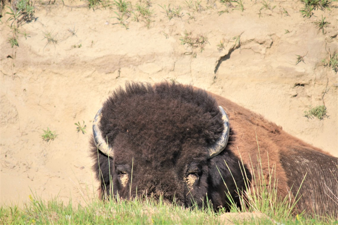
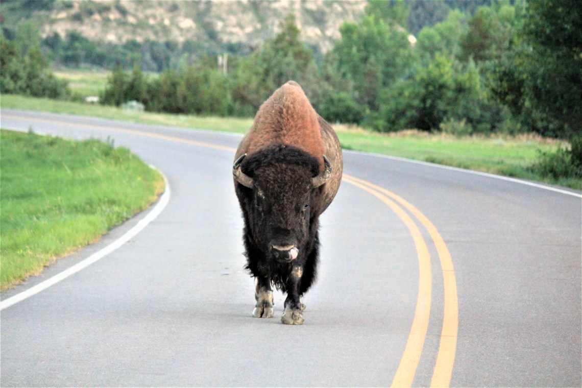
The following evening, after a day of hiking a stretch of the beautiful Maah Daah Hey Trail, watching a herd of buffalo walk across the road 10 feet in front of the van and seeing another God damn rattlesnake slither along East River Road north of Government Creek, I couldn’t wait for dusk. Animals move at dawn and dusk. I wanted to see the elk again, if only to see them silhouetted, each tine a distinct line against an evening sky. I arrived a little earlier today, just as the sun was beginning the set. The ridgeline was bathed in gold. Every detail of the landscape crisp. I set up along the same stretch, looking up at the ridgeline and began to wait.
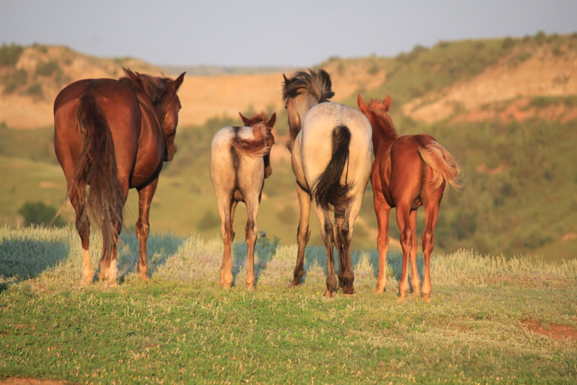
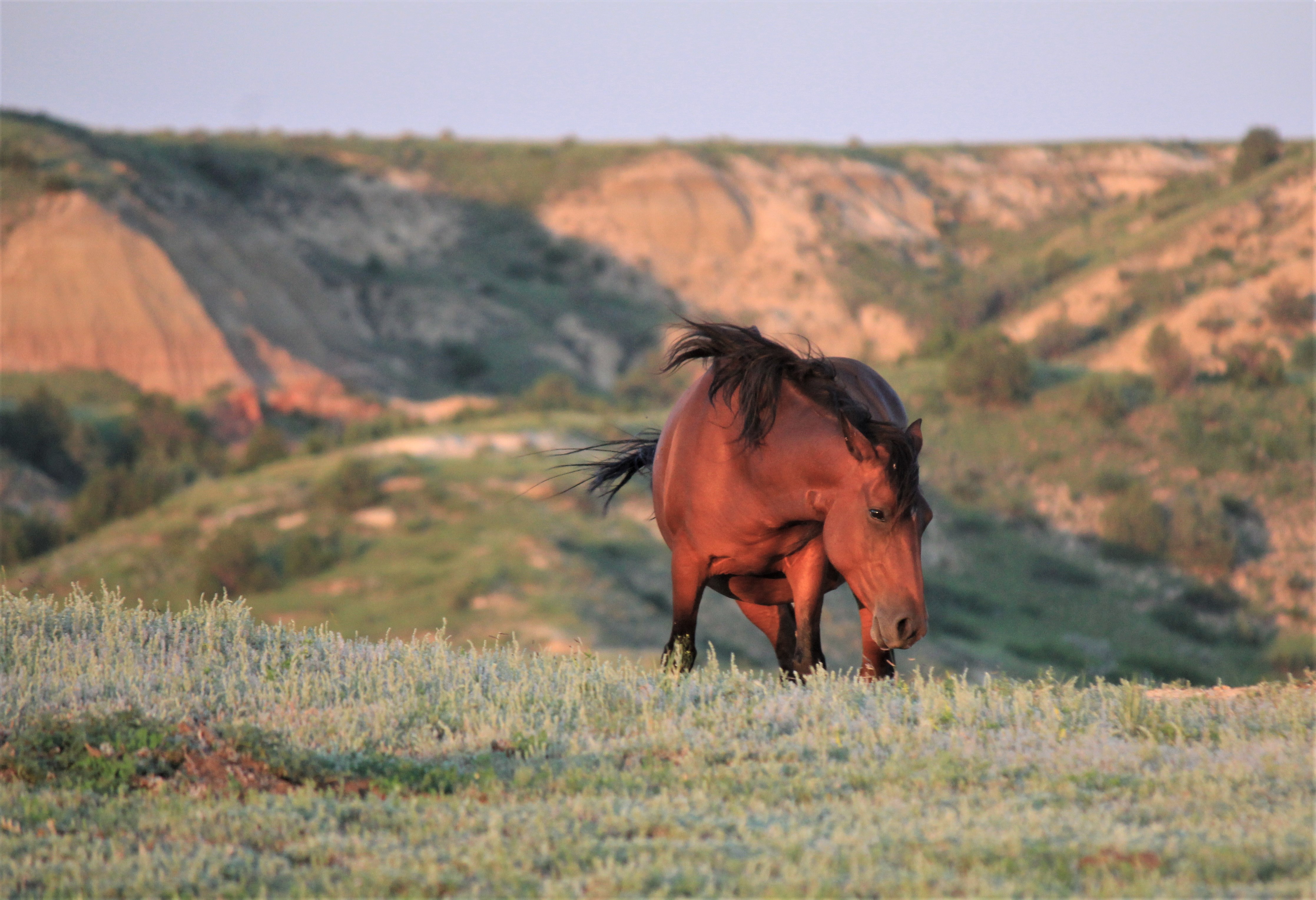
The first wild horse to appear on the ridge was a muscular chestnut stallion, reddish in the evening sun. Others soon followed. Young foals, mares. Slowly they made their way along the ridge, then began to descend into the meadow. I slowly moved into the meadow toward the band, with each careful step afraid of spooking. Within a few minutes I was close enough to hear them eating, hear their tails swishing away files. Their skin smelled of lathered sweat and old leather. Suddenly, but gracefully, they formed a line and turned away from me. They remained like this, motionless, rumps in my direction, until I began to move back down the hill.
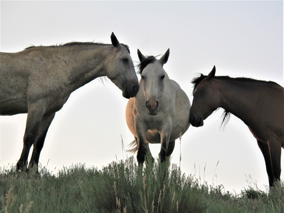
Near the bottom of the hill, there is a small bluff to my right. I thought if I ducked behind the bluff I could come up on the other side and get a few more shots. As I moved below the bluff, three horses appeared at the top, a cream mare in the middle. For a moment they stood motionless, looking down at me. The mare was looking directly into my eyes. It was unsettling. She was speaking to me. She wanted me to be there. I looked at her mane, windblown to one side, her beige nose and black ears. Then I stared into her dark, bottomless eyes. Slowly, deliberately, the two horses on either side of the cream mare, turned to faced her. Then one by one they gently rested their head against the side of the her stomach. She was pregnant. For a moment I bowed my head in wonder. As I took photograph after photograph, I felt a tear running down the side of my face. I knew what this meant. I understood what she was saying to me. Just before I walked around the bluff, I turned for one last look. They were gone and suddenly I felt broken.