And if they had the words I could tell to you
To help you on your way down the road
I couldn’t quote you no Dickens, Shelley or Keats
‘Cause it’s all been said before
Make the best out of the bad, just laugh it off
You didn’t have to come here anyway, so remember
Every picture tells a story don’t it?
Every picture tells a story don’t it? – Rod Stewart, Every Picture Tells A Story
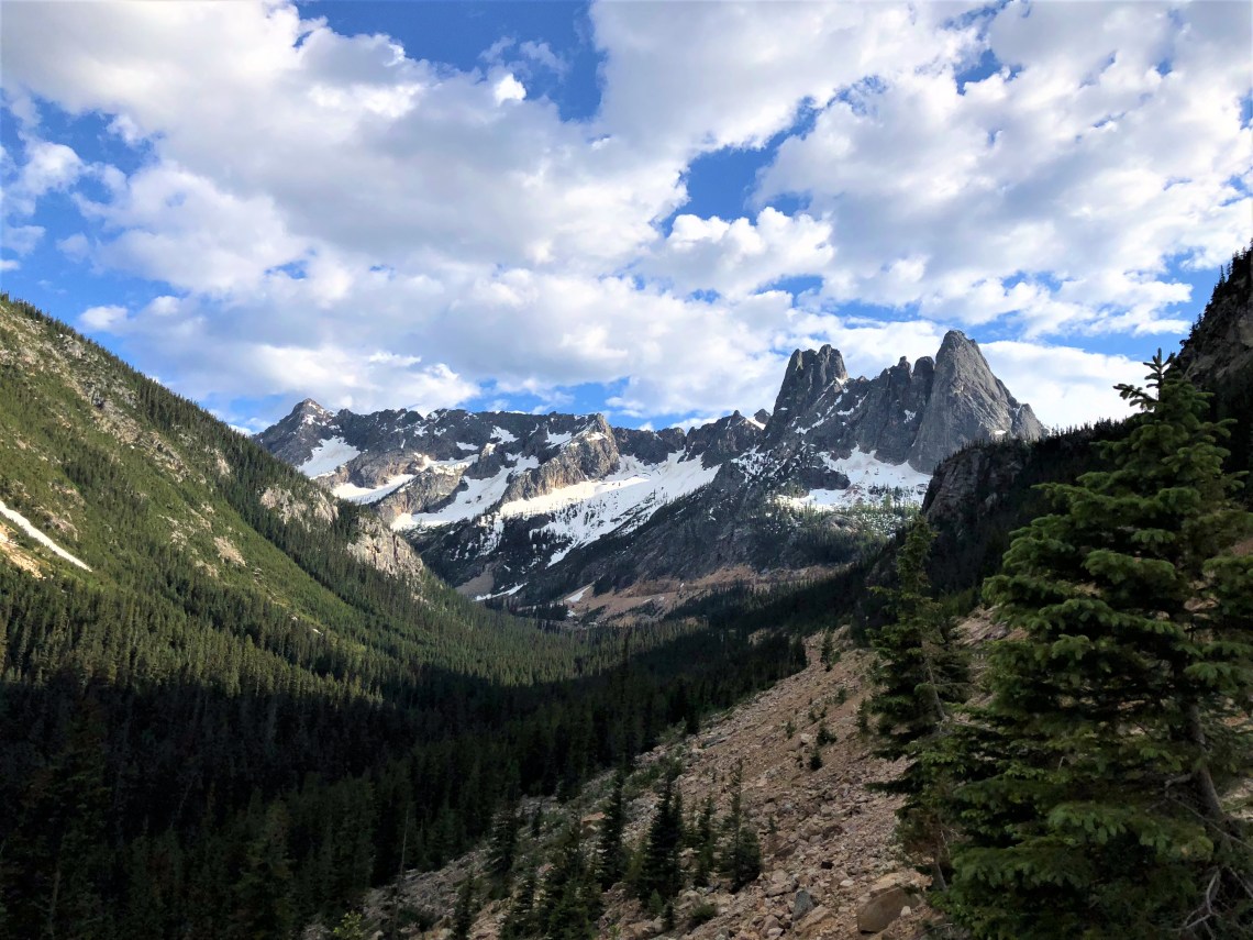
As I slid south along the slender blue ribbon of Ruby Arm on North Cascades Highway, West Glacier, Montana was still a solid ten hour drive and I wanted to put a dent in it before sunset. Twisting through Washington Pass, the road abruptly turns on itself, framing Liberty Bell Mountain’s gaping jawbone of granite teeth. Separated by alkaline rich faults, she looms above spires formed 49 million years ago as part of the Golden Horn Batholith. To the east, Kangaroo Ridge is bathed in sunlight, her serrated headdress golden bronze. Edging the road, hollowed by crystal runoff, drifts of snow lay rimmed in black.
Winthrop sits in Washington’s lush Methow Valley, an old west town with wooden boardwalks and storefronts that resemble a California mining town during the gold rush. Three Fingered Jack’s Saloon – Washington’s oldest saloon – Oliver’s Artisan Kitchen and Grubsteak & Company line the one stoplight town. Highway 20 turns south in the heart of Winthrop, following the Methow River toward Twisp, Pateros and Route 17 which will lead me to the mighty Columbia River, Grand Coulee Dam and my home for the evening, Lake Roosevelt National Recreation Area.
With headwaters in the Rocky Mountains of British Columbia, Canada, the Columbia River flows northwest, then south into Washington. Turning west, it forms most of the border between Washington and Oregon before finding the Pacific Ocean. 1,243 miles long, extending into seven states, tonight the Columbia rushes past my campground. A warm wind, sweeps across the river, reaching south toward the Palouse hills, gently rustling arid fields of wheat. White beams along the upstream face of Grand Coulee Dam, are reflected in the black water, forming perfect lines of shimmering light. Somewhere in the distance, music drifts on the water, a floating mist of tender sound lulling me into darkness.
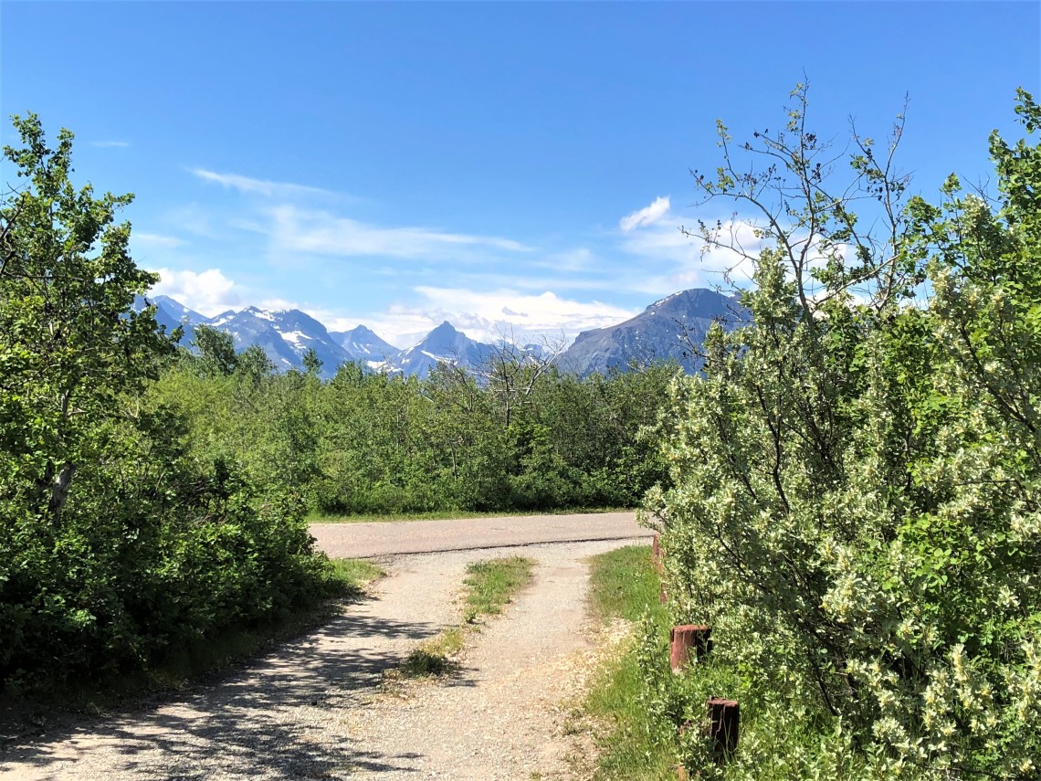
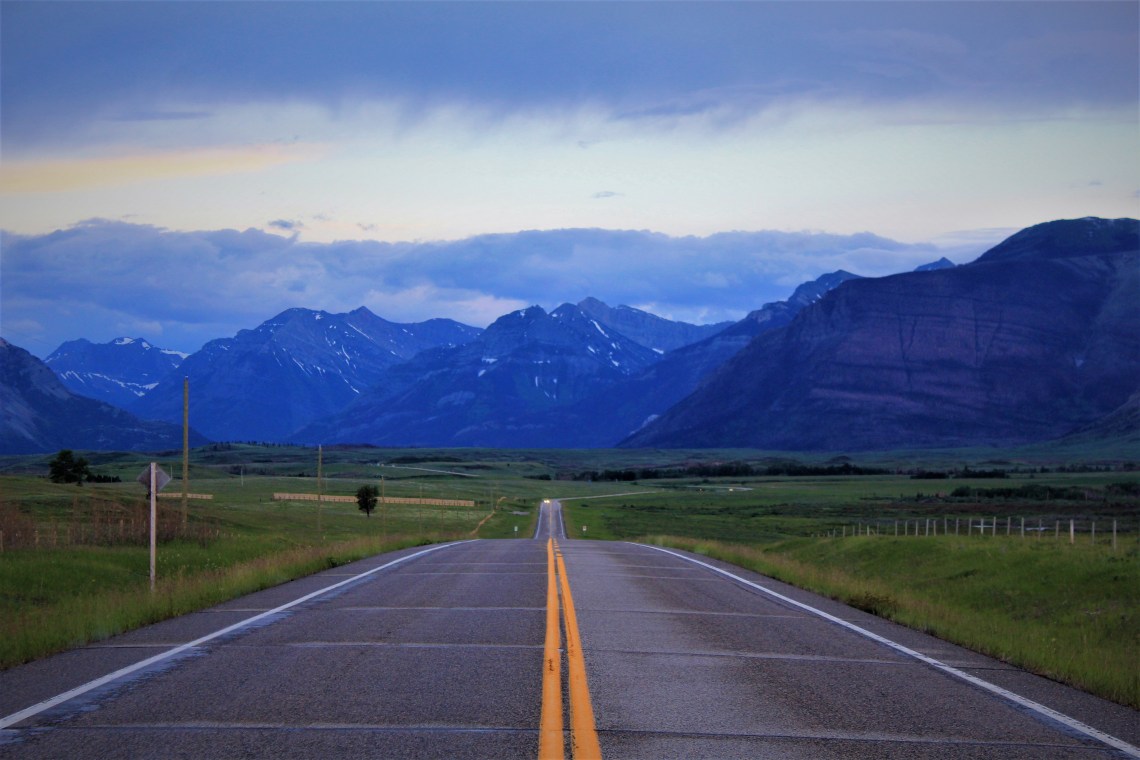
Serenaded by a late afternoon wind, Interstate 90 sweeps through the Spokane Valley, crossing the Spokane River, to begin skirting the evergreen mountains of Coeur d’ Alene National Forest, in the Idaho Panhandle. Near St. Regis, Highway 135 begins to follow the Clark Fork River north toward Nirada, Elmo and Wild Horse Island, near the southwest corner of Flathead Lake. An hour north, West Glacier sits on the boundary of Glacier National Park, at the foot of Going To The Sun Road.
I had reserved a campsite for the next two nights in St. Mary, on the eastern border of Glacier. There are two ways of getting there. Following the railroad tracks, Route 2 loops under the southern edge of the park, through the Lewis Range, two National Forests, Great Bear Wilderness Area and the Blackfeet Indian Reservation, before Route 89, then Route 49 finally curve into St. Mary Village. Or cross the park on Going To The Sun Road, which ends in St. Mary. This is not a ‘six of one, a half dozen of the other’ choice. Going To The Sun Road is listed as one of the most scenic roads on earth. After lunch at the Sunflower Cafe in West Glacier – toast, goat cheese, cherry jam and rosemary-sage sausage – the choice was made for me. Going To The Sun Road was still closed near Logan Pass, covered in snow. It is June 18.
Route 2 leaves West Glacier and immediately enters a winding textured corridor of light blue sky above, two lanes of grey below and a wall of evergreen on either side. Near Middle fork, breaks in the treeline begin to appear. To the north, blue mountains climb from a carpeted plain. To the south, Flathead National Forest lays rumpled in a million shades of green. Below, mirroring the Flathead River, westbound trains emerge from tunnels, puffs of dirty smoke visible moments before the engine. Graffiti inscribed boxcars, empty yellow flatbeds and black barrels with stark white lettering, move deliberately through the late afternoon as one. I watch as one parade ends and several miles later, another stream of steel begins. There is something in the surroundings – the river, the mountains, the remote feel of the highway – that lends each train a romantic notion. The possibility that a story is being told, a life being played out with the passing of each boxcar. I admit it’s a silly notion. But one that carries me past the Essex Railroad Depot in Walton, beneath Goat Lick Overlook and north to East Glacier, before casually slipping away.
Leaving the small town of East Glacier, Route 49 heads north across Two Medicine River and above Lower Two Medicine Lake, a baby blue puddle in a vast landscape of color. Also known as “Looking Glass” in honor of a Blackfeet Chief, the road is narrow, with few places that aren’t the beginning or end of a curve. Before turning east, away from the park and intersecting with Route 89, the land takes on two shapes. Eastward, the land stretches into valleys, rolling out to the horizon. To the west, uneven peaks along the Lewis Range compete with clouds. I wind through both landscapes, scenes sliding through a faded red viewer, changing with the downward movement of a single finger, until entering St. Mary, where the smooth lands to the east disappear. I set up camp in near darkness and fall asleep in minutes.
A big Montana sky greets me in the morning as I walk along a paved path through underbrush of Pacific yew toward the bathroom. A couple of kids are kicking a soccer ball in front of small RV, each telling the other how good they are. The woody smell of last night’s campfires hangs in the air as I watch a skittish red fox, tail thick as a full windsock, scavenge an empty campsite. White streaked mountains stand surreal in the distance. There are no showers, so I duck my head under the ice cold water in the sink of a tiny room where dishes are cleaned, before walking back to camp. A portion of Going To The Sun Road is open, from St Mary to Jackson Glacier Overlook, about 12 miles west. My plan is to drive to the glacier, before turning around and taking a few hikes on the way back.
Going To The Sun Road ends with a metal gate in front of several feet of snow, a small parking lot sitting to one side. A few people mill around the sign describing the glacier as the seventh largest of the remaining 25 glaciers in Glacier National Park. In 2005 the glacier was measured at 250 acres. When first documented in 1850, Blackfoot Glacier as it was then known, now separated from Jackson, covered 1,875 acres. Between 1966 and 2005, Jackson Glacier lost almost a third of its acreage. Through a clearing of pine forest, the saddle shaped glacier sits defenseless, framed in granite and billowy clouds.
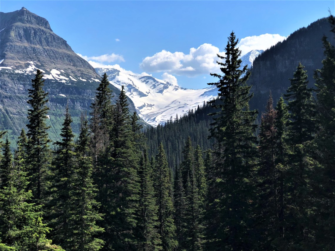
Near the beginning of St. Mary Falls Cutoff Trail, the thick forest of subalpine fir opens to a direct view of Dusty Star Mountain. Triangular and flat-faced, it towers over Saint Mary Lake. Looking south, Almost-a-Dog Mountain, named for a Blackfoot warrior and Little Chief Mountain, rest in a crooked line. In several places along the trail, water runs down the mountain, pooling in shallow gullies below my feet. In a stand of trees blackened by fire, a small doe grazes on fresh undergrowth. She looks up as I pass and has no fear. Nearby, a woman bends to take her picture. The deer looks up, then continues to eat, before slowly tuning and moving down the wooded slope. As I pass, I catch a brief glimpse of the woman smiling.
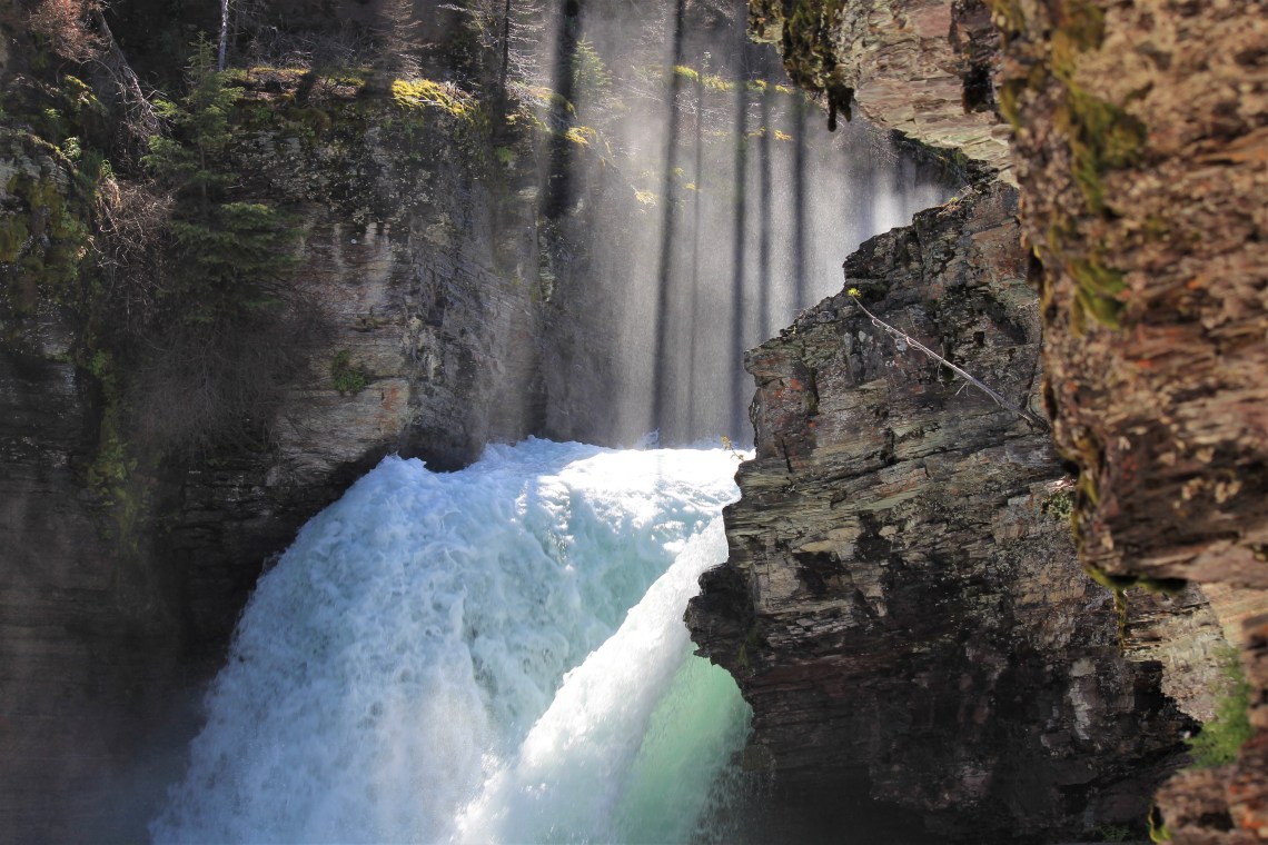
You hear St. Mary Falls well before you see them. It is the last days of spring and the falls are at the height of their power. Dropping roughly 35 feet in three separate tiers, I can feel the hum and pounding of the water as it violently rushes through a narrow gorge, before coming to a churning rest, aqua-green. Black lines of light hang above the falls, as small, slate-grey American dippers bob along the rocks, before diving in search of food. It’s a warm day, but a cool breeze lifts from the water and carries across the wooden footbridge. I scramble up a large group of boulders for a better view of the falls. An old tree hangs precariously over the packed dirt that surrounds the rocks, a layer of mist darkens the soil. The same woman who was taking photographs of the doe, leans against the tree, snapping photo after photo, stopping only to adjust her broad brimmed hat. I tell her to be careful. She looks at me and smiles. She is the most beautiful woman I have ever seen.
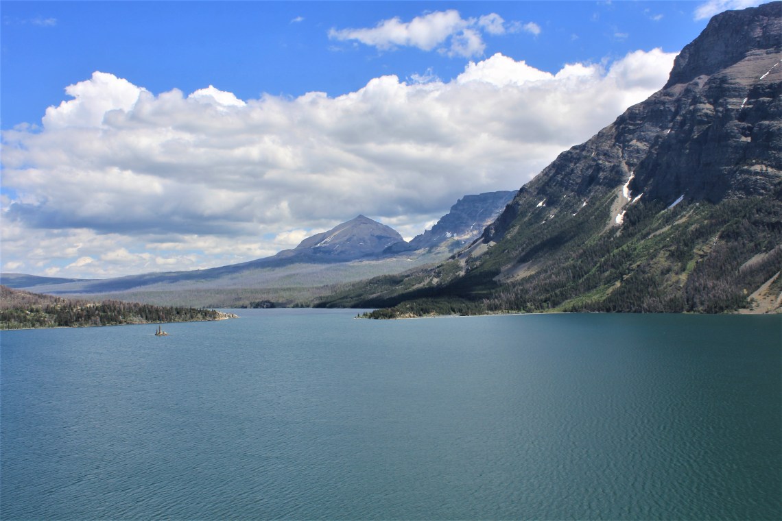
Wild Goose Island lookout is a series of small gravel platforms just below a large parking lot. Each offers a commanding view of the magnificent peaks encircling Saint Mary Lake with Wild Goose Island being the centerpiece. While the elevation of the lake itself is 4,484 feet, the surrounding peaks soar from the water’s edge to well above 8,000 feet in elevation. Red Eagle Mountain, Mahtotopa Mountain, Little Chief Mountain, Dusty Star Mountain and Citadel Mountain, form a procession along the south side of Saint Mary Lake. Gunsight Mountain and Fusillade Mountain jealously guard the lake’s far shore.
I wander down to the lowest platform, just above the treeline and begin to take photographs. A white haired man sets up his tripod next to me and says hello. He has an Australian accent. We strike up a conversation. He is a friendly man, an interesting man. After ten minutes I discover he is also a man who likes to hear himself talk. As he begins to quote author Jack Holterman, “He calls this view the grand march of mountains. I couldn’t agree more. Reminds me of…..” I’m listening, but I’m thinking of the woman.

After another early morning dip in the wash basin, I broke camp. The kids were gone and the red fox had moved on to another venue, but the smell of burning wood still hung in the air, as I started the van. A few yards down the gravel road I knew I had a flat tire. Damn it. First one of the trip. I nursed the van a short distance to the end of the road and parked in front of Park Cafe and Groceries. The tire is not completely flat, but seriously low. My cell didn’t have a signal, so I walked in and asked if there was a pay phone nearby. I also asked if there was a gas station or tire store nearby or in Babb, that can plug a tire. The young man behind the counter points at the phone on the counter.
“You can try this guy who lives a few miles up 89. Indian Jim. Fixes cars in his front yard. If anyone can fix it, Jim can. Problem is, he very rarely answers his phone.”
He gives me Jim’s number and I call. He answers on the 5th or 6th ring.
“Hello, is this Jim?”
“Yep.”
“Hi Jim. The fella at Park Cafe gave me your number. Said you were the man when it came to fixing tires. I think I picked up and nail. Can you plug a tire?”
“Yep.”
“Great. How do I get to your place?”
He gives me directions. It’s about 9 miles north, near Duck Lake Road. I’m hoping I can limp that far.
“I’ll see you in about 15 minutes.” I thank the young man for the use of his phone and the tip.
“Indian Jim will take care of you. Tell him Jason says hello.”
“Will do. Thanks again.” I walk out wondering how many businesses would let me use their phone without a second thought and what I’m going to find at Indian Jim’s.
Jim’s place sits off the road at the end of a long dirt driveway, just inside the western border of the Blackfeet Indian Reservation. Cars in every state of disrepair are scattered across the yard. Backdropped by snow capped giants, an old rundown house and trailer look down on an open barn, filled with cars and parts that look as if they’ve been randomly dropped from the sky. Several cars are up on cinder blocks, doors open to the elements. As soon as I park and get out, I’m greeted by a couple of dogs who eye me as a meal, but are more than friendly. I kneel down to rub their matted fur. A lanky, thin man with long black hair tied back in a ponytail walks out of the barn. He’s wearing blue jeans and a white tee-shirt, wiping his hands on a faded brown rag. I stand and extend my hand.
“You don’t want to shake my hand. It’s got some grease on it.” He has a firm, calm voice.
“I don’t mind a little grease.” We shake hands. “Are you Jim?”
“Yep. You the fella with a tire needs pluggin?”
“I am. Smitty.”
“Well let’s take a look Smitty. Hop in the van and turn the wheel when I tell you.”
I do as I’m told and after a single turn I hear him say ‘ok. Got it.’
“Something you can fix Jim?”
“Oh yeah. Be right back.” As he walks into the barn a kitten scurrys over to my feet. I pick him up. He’s as cute as a button. But like the dogs, he smells to high heaven. Jim emerges with a long metal tool and a square rubber patch. He lays down on the ground, applies some thick cement to the patch and in one swift movement, one born of practice, he inserts the patch and removes the steel rod. He rolls to one side before slowly rising to his feet.
“Damn, you made that look easy Jim.”
“I’ve done a few of those before today.” He grins. Not a full smile.
“How much do I owe you, ” reaching into my pocket.
“$40.”
That’s about double what a plug normally costs. But it was worth $40 and more considering the circumstances.
“So how long have you lived here Jim?” I hand him the $40.
“I’m fourth generation. My great grandfather settled here over a hundred years ago. Been here ever since.”
“Wow. That’s impressive. It’s a beautiful piece of land.”
“My mom lives in the trailer up there. I look after her. She’s gettin up there.”
“You’re a good son Jim.” Then changing the subject. “So how often do grizzlies come calling?”
“Had to scare one off a few days ago. Came down the mountain and tried to climb the fence.” He points at a dog-eared fence line about 30 yards from where we stand. “They don’t mess with me, I don’t mess with them.” He chuckles. “He was a big fella.”
“Well I can’t thank you enough Jim. You’re a life saver. By the way, Jason says hello.”
“Good kid. Sends people out my way every so often.” He pauses. “Yep, that plug’ll be in there when you sell that van. Ain’t goin nowhere.”
“Thanks again Jim.” I extend my hand and he gives me a tight handshake.
“You take care Smitty. Safe travels.”
As I drive down the long dusty driveway, I honk and look back. He is standing in the driveway, dirty rag in one hand, waving with the other.
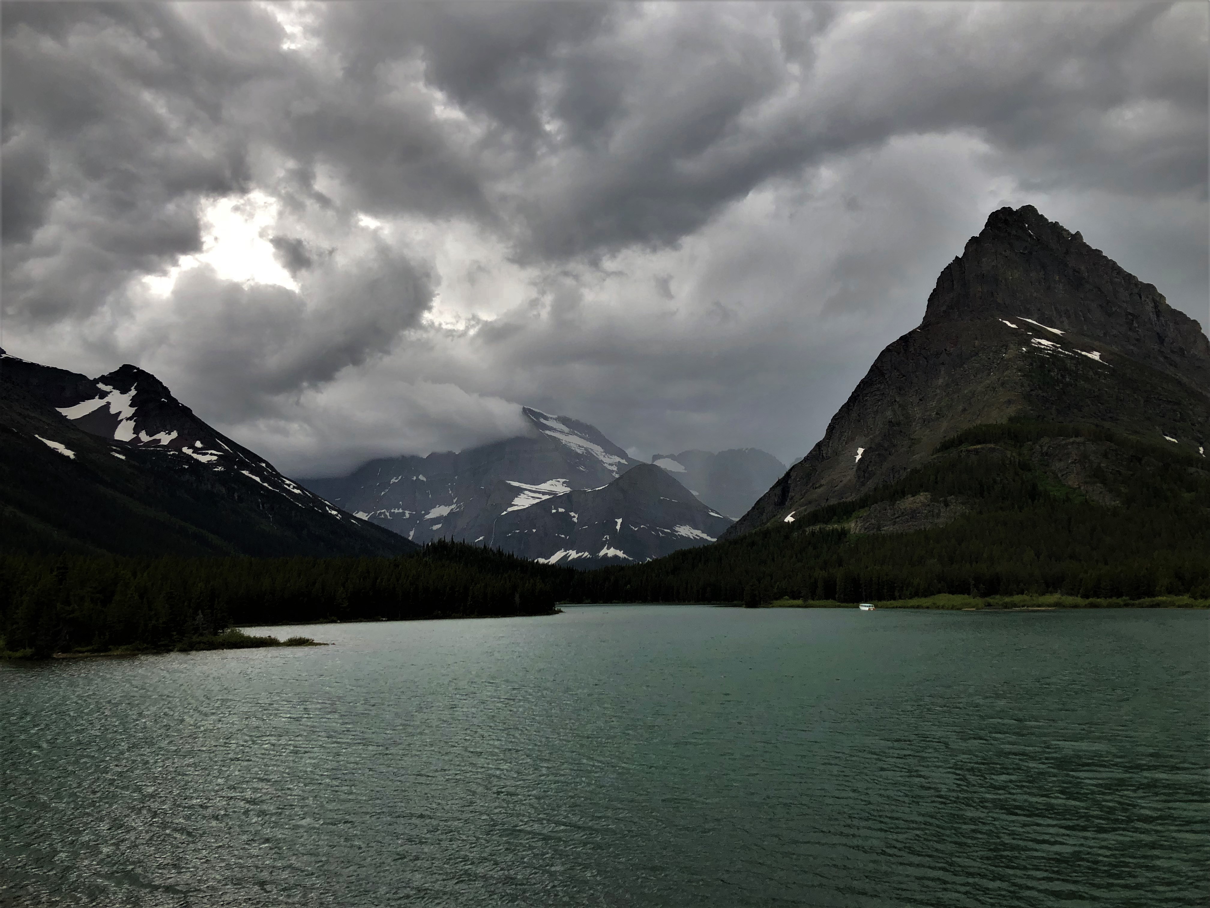
After a great lunch of chili and huckleberry ice cream at Two Sisters Cafe, I turned left near the Cattle Baron Supper Club and drove west on Route 3, Many Glacier Road. Following Swift Current Creek, the road quickly deteriorates into a series of deep potholes, ruts and water filled craters. It never recovers. Even as stunningly handsome Lake Shelburne comes alongside, the road is so pitted and broken, to look anywhere but directly in front of the van is risking serious damage. I concentrate and try to ignore the postcard that is staring me in the face. I am mystified by the deplorable condition of a road inside a National Park and make a mental note to ask a few rangers why the roads are so poor.
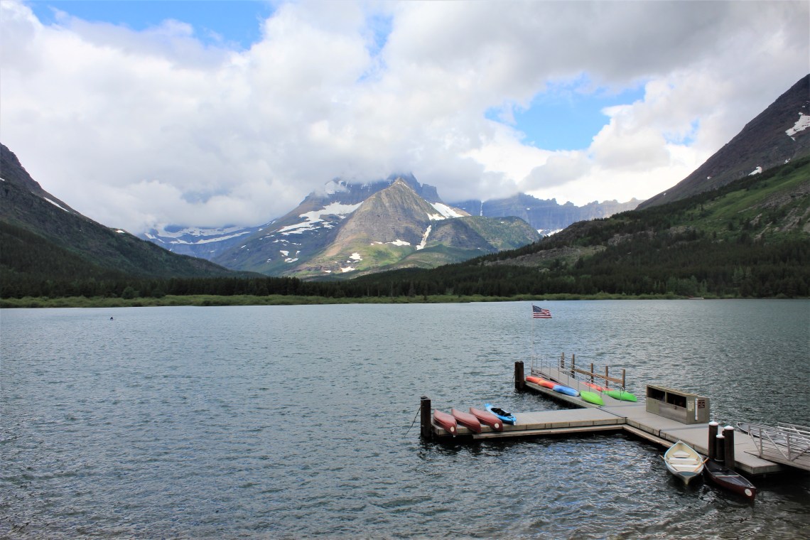
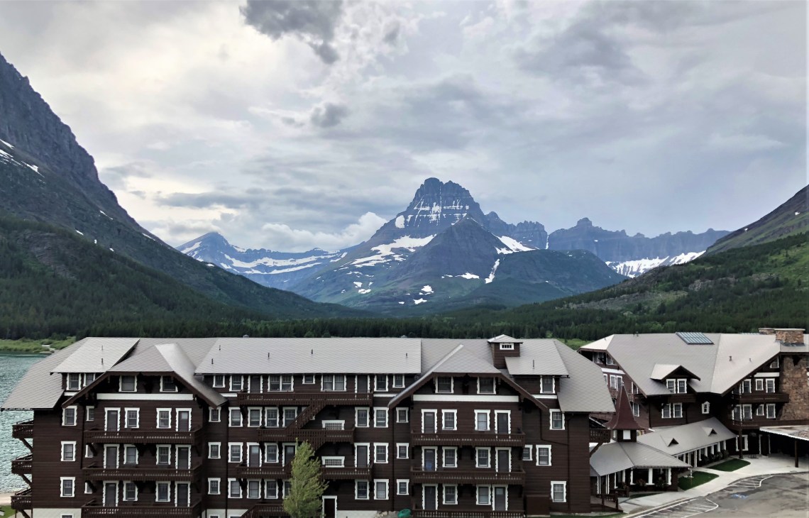
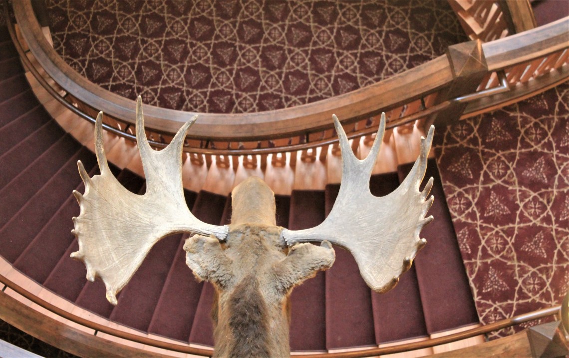
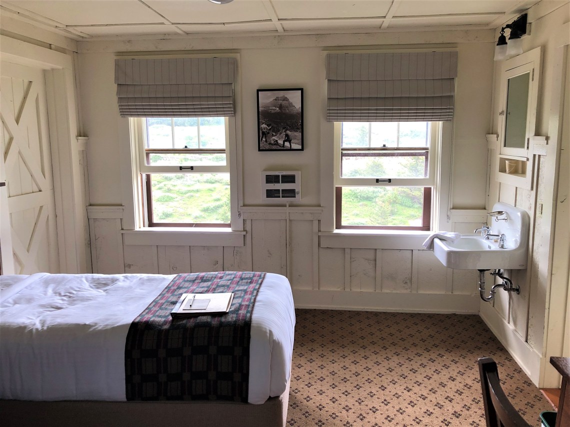
“Built by the Great Northern Railway in 1914-15, Many Glacier Hotel is situated on the shores of Swiftcurrent Lake inside Glacier National Park. All guest rooms are rustic, yet comfortable. In keeping with the era in which the hotel was built, the rooms offer guests modest amenities and old-world style accommodations. There are no televisions or air conditioning. All rooms have private bathrooms and direct dial telephones. A spectacular lakeside setting, one of the best of any of the national parks.” – NPS.Gov. I checked in for an evening of rest and huckleberry mojitos on the terrace. Tomorrow I would board two historic wooden boats, Chief Two Guns on Swiftcurrent Lake and Morning Eagle on Lake Josephine, for a trip into a valley of glaciers.
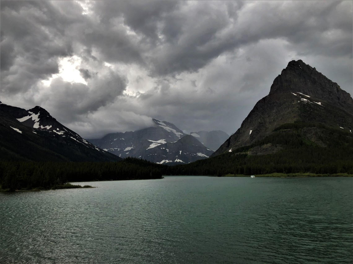
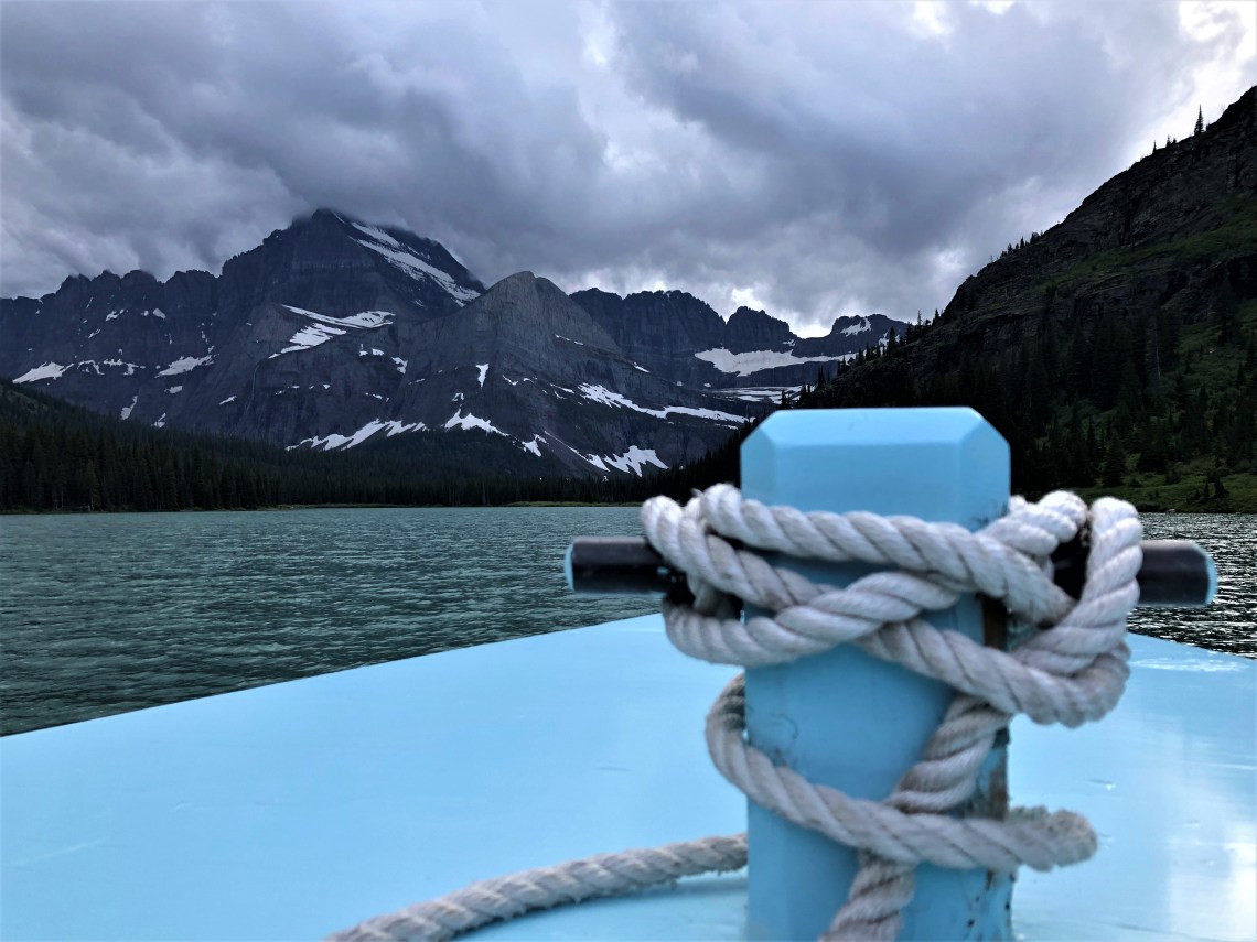
In the morning, the sky was bruised and angry. Battered grey clouds sat low across a dull lake, hiding the tops of triangular blue-black mountains. Each moment brought motion, movement across an already imperial view. I sat on the terrace as rain fell in sheets, pinging off the wooden boats, stinging the water. Chief Two Guns, white against the green waters, her red trim hugging the waterline, silently pulled away from the dock. She gracefully moved through the water toward the short steep space between Swiftcurrent and Lake Josephine, before disappearing behind a dark line of evergreen, beneath the gaze of Grinnell Point and into the upper reaches of the brooding lake. I sat in a wooden rocking chair, watching scenes from a grandiose film slide along the ever changing horizon.
As the rain stopped and the afternoon skies began to part, I purchased my ticket and boarded Chief Two Guns. The lake was calm as we motored across, docked, disembarked and walked 0.2 mile over a steep hill to the shores of Lake Josephine, where we boarded Morning Eagle. Robin’s egg blue with an open bow, she cruised to the head of Lake Josephine, directly toward the retreating Grinnell Glacier. I sat on a small wooden bench and tried to document an eternity of land, water and sky.
Banff, Alberta, Canada is about 5 hours due north of Many Glacier. At the Canadian border, I would be entering Waterton-Glacier International Peace Park, Canada’s portion of Glacier-Waterton. Alberta Highway 6, briefly skims the park before crossing Belly River and traversing the heart of Blood Indian Reservation. Looking south as I cross the flat cement bridge, Belly River curves around several rocky sandbars and disappears into the trees. Mountains and a still angry sky add the perfect backdrop to a scene that would please even Norman Maclean. I pulled to the side of the road, walked back onto the bridge and snapped several photographs. As I was walking back to the van, a black sedan pulled off the road and skidded to a stop about 50 yards distant. A young man leaned out of the backseat window and began shouting.
“Get the fuck off my land. Get the fuck off my land.” There was pure anger in his voice. “Get the fuck off my land white boy.” I could hear other voices from inside the car telling him to get back inside and shut up, but he persisted. “Get the fuck off my land white boy. Fuck you white boy.”
My initial reaction was shock. I wondered if he was a drunk in a car full of otherwise sober young men. The car remained still, idling, but no one got out. I tried to gauge if this posed a physical threat. In the moment I was more angry than afraid. Without weapons, four on one. If someone initiates a physical confrontation, I’m all in. I’m old but fiesty. No question I would get my ass beat, but a couple of them would know they had been in a fight. Adrenaline kicked in as I tried to remain calm on the surface. As I slowly walked back to the van, not turning my head in their direction, the black sedan squealed onto a side road, throwing up a cloud of dirt and dust in its wake, the young man still hanging out of the rear window. His words were lost in the whirl of tires and dust, but I couldn’t miss his extended arm and upturned middle finger. One last silent fuck you. For the next half hour I checked my rearview mirror every few minutes. The incident left me shaken and sad.
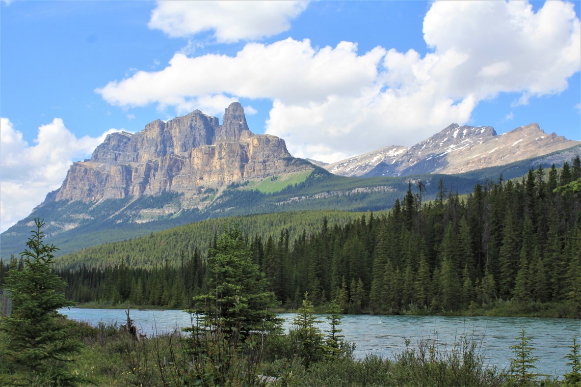
Canadian Highway 2 runs along the eastern edge of the Rocky Mountains. To the east, farmland flows mostly flat across a landscape broken only by barbed wire fences. Miles of brilliant green spring wheat and the pure yellow of canola fields stretch to the horizon. A white farmhouse sits at the top of a dimpled ridge, treeless, a metal silo its shining companion. Great ranches of cattle spring up in light brown fields, with long steel troughs of water forming uneven lines. Where the road rolls, patches of color lie stitched in the distance, a boundless mural of pastoral beauty. Where the road bends westward, the Rockies rise from the earth, solid blue and timeless. It is a visually stunning drive between two worlds. I look to my right and the seat is empty.

As good fortune would have it, my home for the night, Lake Louise Campground, was just around the corner from Lake Louise Village Grill & Bar, the only place open when I pulled into town. I walked upstairs, past the bar and sat in a brown padded booth. I was tired and starved.
“What’ll it be honey?” She was looking down at me, pencil in hand, not a trace of a smile.
“I think I’ll have a plate of spaghetti and a glass of ice water.” I hand her back the worn menu. “Thank you.”
“Great choice honey.” She turns, sliding the pencil behind her ear. Her red apron strings bounce as she walks. I feel like I’m in a scene from ‘American Graffiti.’
As it turns out, the spaghetti was a very good choice. They even threw in a green salad. “Here you go honey.”
I returned to camp in the dark, placed some food in a bear locker and tried to settle in. I was excited for the next day. I’ve wanted to see Lake Louise and Moraine Lake since I was a teenager. Are the waters really turquoise? Are the glaciers close enough to touch? Is the historic Fairmont Hotel as grand as the photos? I was excited to be here, in this place and time. But as I fell asleep, my mind wandered in an unexpected direction. What would it have been like to drive through today’s majestic landscapes with the woman from Glacier? How would it feel to turn and see her smile? To feel the warmth of her skin against my hand? How would it feel to kiss the woman I knew was forever lost?