
If you are faced with a mountain, you have several options. You can climb it and cross to the other side. You can go around it. You can dig under it. You can fly over it. You can blow it up. You can ignore it and pretend it’s not there. You can turn around and go back the way you came. Or you can stay on the mountain and make it your home – Vera Nazarian, Armenian-Russian American writer
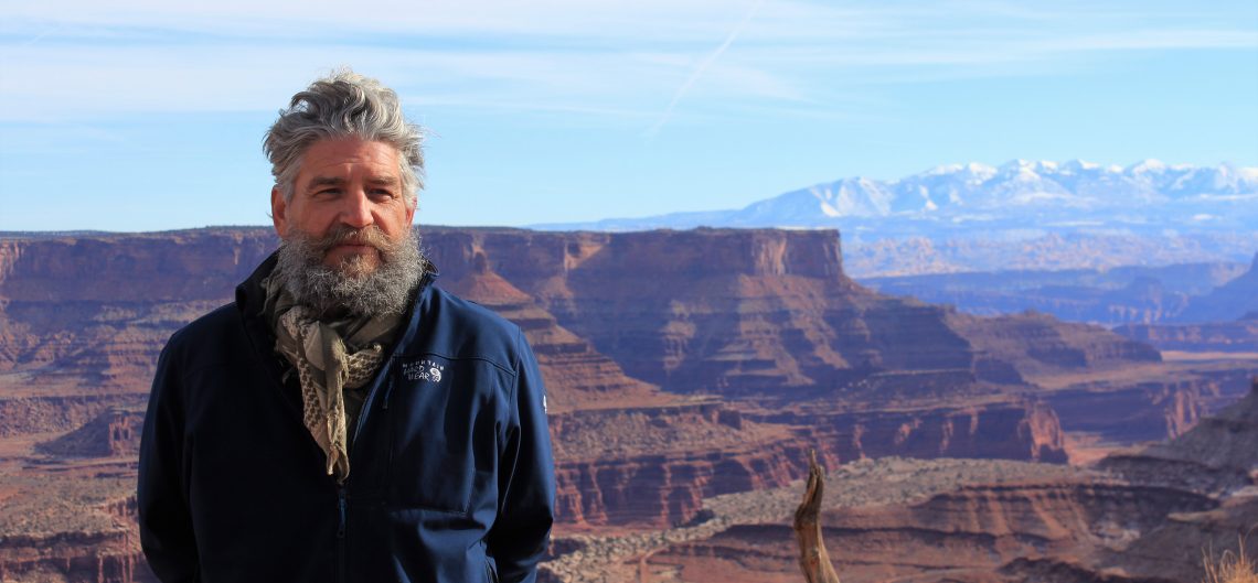
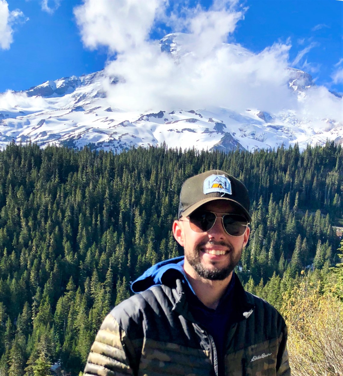
We rose before dawn to a blue tinged sky over a shimmering calm ocean. Today was a travel day. A dry breakfast day. Braden and I had a three and a half hour drive east, from the Pacific, to Mount Rainier National Park. Our goal was to get in some hiking before driving to Seattle for his 8:00 PM flight back to Detroit. We broke camp, said a final farewell to the ocean, found Highway 101 and headed south in search of a quick cup of coffee. This would be an odd departure from my normal routine of spending several days exploring a park. For the first and only time on this trip, I knew I would feel like a tourist.
On the outskirts of Montesano, Washington, just north of the Chehalis River, US-12 turns east before intersecting with Route 8 and flanking the northern boundary of Capital State Forest. Further east, Olympia sits at the bottom of Budd Inlet, a slender blue strip that leads north to Puget Sound and the Salish Sea, resting between the United States and Canada. Dropping south through small towns and rolling brown farmland, the road suddenly finds a right angle onto Mountain Highway, passing the blue fingers of Alder Lake. Tracing the Nisqually River, the only watershed in the United States with its headwaters in a national park and its delta in a national wildlife refuge, Mount Rainier looms in the east. Near Tenas Creek, Paradise Road enters the park and the dense green skirt surrounding a glacier streaked volcano.

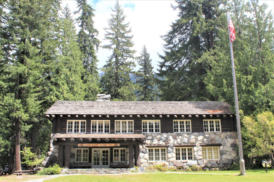
Seven miles into the park, Longmire Wilderness Information Center rests against a grove of tall fir. Made of local timber and stone in 1930, a coarse green lawn spotted with a semi-circle of rocks in varying sizes and a metal clanging flagpole, greets visitors from late May until October. We walked inside and asked a ranger’s advice on how to spend a productive eight hours in the park. Ideas and maps were exchanged. Afterward, we found a place to sit in the shade and made some decisions. There would be no long hikes today. We would sneak in a few short excursions along the way, then in true tourist fashion, visit as many sites near the road as time would allow.
“I don’t want to miss my flight Mr. Smith.” An earnest plea.
“You won’t. But we might cut it close.” Knowing we would make the flight, but adding just a sliver of doubt to mess with someone so easily messed with.
“Please don’t cut it close.” Pleading.
“Let’s find a trail.” Ignoring.
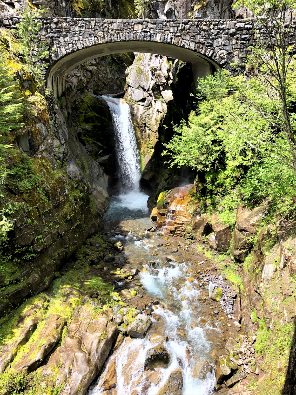
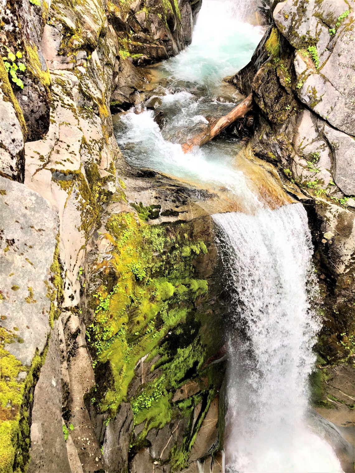
Dramatically framed by a gracefully arching stone bridge, two tiered Christine Falls, is the last falls along Van Trump Creek. Falling 69 feet in drops of 32 and 37 feet respectively, Christine flowed unchanged for decades. Then, on August 14th, 2001, a glacier debris flow violently swept mud, dead trees and rock down Van Trump Creek, altering the lower falls forever. Subsequent floods in 2003 and 2006, have scoured the creekbed to bedrock, removing all vegetation and doubts about the ever-changing temperament of nature.
It’s a short descending hike from the bridge to the bottom of the falls. The trail is rutted, muddy and slick. A short wooden fence acts as a railing and several people vie for a handhold. Three women in elaborately embroidered floral kurtas, wearing what appear to be plastic slippers, grip the rail, taking the smallest steps possible. Mud covers the toes of their slippers. There is a look of terror on their faces. Further down the path, an elderly couple in tennis shoes loudly berate one another for thinking they could make it to the bottom of the falls. “What were you thinking Shirley?” “Shut up and walk Stan.” I veer to the left, away from the fence and into the muck, thankful once again for a great pair of boots. I can hear Braden laughing over my shoulder. Later, when we hike back up and stand on the bridge, I say, “What were you thinking Bray!” We both laugh out loud and I’m not sure who is more immature.
Ricksecker Point sits on the north side of a one way road that loops south toward Paradise River. From here, the majesty of Mount Rainier National Park is on clear display. Nisqually and Wilson Glaciers, rest with blueish white bergschrunds beneath Crater Rim at 14,200 feet. Point Success rises above Kautz Glacier, a false summit 90 feet below Rainier’s highest ridge, while to the south, 5,958 foot Eagle Peak holds the western edge of the Tatoosh Range and cone shaped Tumtum Peak slouches in Nisqually Valley. A pallet of warm color against an unforgiving mountain of white. A visual feast of depth, dimension and sky.

Slightly uphill from Henry M. Jackson Memorial Visitor Center, Paradise Park lies covered in snow below Muir Snowfield. Retreating glaciers reach down from the summit, thick fingers of snow and ice melting into westward flowing creeks and rivers. To the south, Pinnacle Peak appears, a serrated pyramid of coal black stone. On the concourse next to the visitor center, circular brass markers with the names of volcanoes are embedded in the cement. From British Columbia, Canada to northern California, the Cascade Volcanic Arc, part of the Pacific Ring of Fire, stretches over 700 miles. With Mount Baker, Adams and Hood in the north and Lassen Peak and Medicine Lake to the south. To all who look down, the markers are a gentle reminder that the Cascade volcanoes remain awake, brooding and uncertain.
Braden and I took a seat in the somewhat crowded visitor center. High ceilinged, with floor to roofline windows, the central room is an inviting architectural gem, with comfortable seating arrangements scattered in clumps across the freshly polished cement floor. Many people are engaged in conversation, while an equal number, heads bowed, search their phones, grateful or bemoaning the fact that suddenly they have access to the outside world and all the temptations and obligations it represents. Off to one corner, next to an expansive staircase, a large scale model of the park dominates. People huddle on the edges, pointing at features of the landscape. Some exchange brief stories, a hint of familiarity in their tone.
“What do you think Bray.” Neither of us are on our phone.
“It’s unreal. I wish we had more time. But I’m glad we came over.”
“We still have a few hours before heading to Seattle. There are a couple of lakes not too far from here that we should see and a couple of waterfalls as well.”
“As long as we don’t miss my flight.”
“At 10:00, right?”
“8:00. Smartass.”
“Are you sure?” He’s such an easy target, I can’t help myself.
“Come on. Let’s walk over to the park and climb on the snow.”
“What? Are you twelve?”
“You don’t want to climb on the snow and take a few pics?”
“I bet I can get there faster than you,” and we walk-run out of the visitors center, grabbing onto each other’s sleeve and pulling.
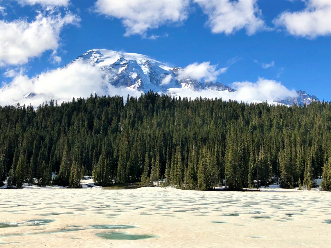
Reflection Lakes lie under a blanket of pot-marked snow, surrounded by triangular fir creating a perfectly straight frame holding Mount Rainier and the halo of clouds laid upon her head. Where the sun has bored through dusted light brown snow, green water sits in small circular pools. Braden and I walk to the edge of the snow, take a few steps down toward the treeline for a better view of the lake and sink into the deceivingly deep snow. Laughing, we turn and head back to the road.
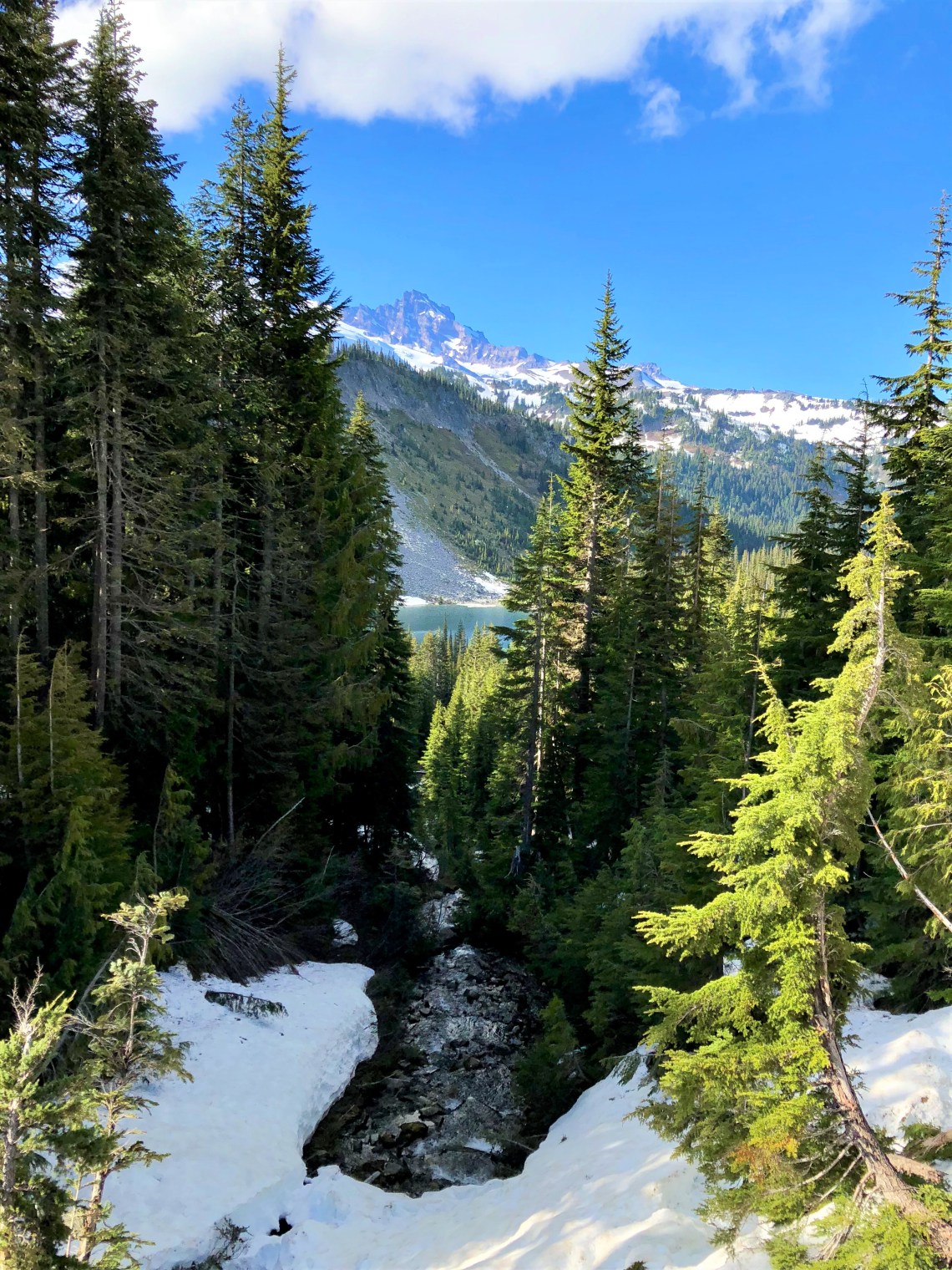
Unlike Reflection Lake, Louise Lake is free of snow. Sitting in a glacier gouged basin, with rounded slopes of scree, the sun has melted everything except what remains hidden among the forest of fir. A clear stream runs south from the lake, sometimes disappearing beneath the snow, only to emerge as Upper Sunbeam Falls. Cascading over several tiers of rock, the falls spread in a triumph of sound. Clear and precise, the water finds a soothing note and holds it until winter, when the ice returns and she is silenced.

We stopped at Narada Falls and hiked a small portion of the surrounding trails on our way toward Longmire and the park exit. It was 4:45 when we hit Highway 161, an arrow straight road to Seattle International Airport. GPS said we were two hours away. Perfect.
As we pulled into the airport, I asked Braden if it was worth the trip out.
“Are you joking, Mr. Smith?”
“Just wondering.” I knew he had a great time. I knew he had experienced sights and moments he would store and carry throughout his life. But a piece of me wanted to hear it. I can’t explain why. It seems so petty.
“I had the best time. I hate to see it end, but I start my job in a few days. I wish I could stay longer.” He is painfully sincere. “You?”
“I had a wonderful time Bray. I would hike with you any time. Thanks again for coming out. It means a great deal to me.”
He started to get out of the van but hesitates. Then he turns back and looks at me.
“Hey, Mr. Smith. I get it. I think I understand part of the reason you’re out here. It hurt everyone when Obs died. He was a great kid. He was like a big brother to me.”
I didn’t see this coming. A catch rises in my throat. My head involuntarily sinks toward my chest before I’m able to speak.
“Oliver thought of you as his little brother, Bray. Your protector. That’s who he was.” I’m struggling to keep my composure. “You’re a good man Braden. I’m always here for you. I love you.”
We step out of the van and give each other a hug.
“I love you too Mr. Smith. I’m here for you as well.”
He walked into the airport, turning once to wave. I stood and watched him disappear into the bustle.


How lovely that you and Braden were able to share this experience together. Great kid. Incredible pictures. And as always, your writing skills are eloquent and very impressive.
LikeLike
I am glad you are such an eloquent writer because I feel like I am on the journey through your stories. I’m also happy that you are getting to experience things others dream of.
LikeLike