Omnia mutantur, nihil interit – All change, nothing perishes – Ovid, 43 BC-17 AD, Roman poet
Exiting Yosemite south through Wowana, on Route 41, the road swings past Fish Camp’s wooden general store and the steam engine of Sugar Pine Railroad. At Coarsegold, Route 152 heads west. Near Raymond, trident shaped Eastman Lake Recreation Area waits, wavering blue. Looping into the flat open land of California’s San Joaquin Valley, great furrowed fields of brown lie unburdened, awaiting seed. Orchards of perfectly rowed almond and walnut trees line both sides of the two lane highway, colorful roadside fruit stands tucked between. Hunched workers in broad brimmed hats, scramble down pickup tailgates, boots raising dust.
Almost imperceptibly, the valley begins to climb the Diablo Range. To the south, San Luis Reservoir and its world class fishing, sprawls across miles of rolling bluffs. High on Pacheco Pass I pull into a turnout. Low clouds forming a perfect line, sit over small hills and rest in valleys. It’s one of a thousand times I’ve stopped to point my camera at something I need to record. I’m drawn to juxtaposition – composition and color. It’s involuntary.
Clearing the Diablo’s, Route 152 empties into another valley and Route 25. Bordered on the west by the Santa Lucia Range, the road stays mostly flat, winding through winter wheat and young vineyards. A pair of beautiful chestnut horses stand together, one resting its head on the other. I pull over on the gravel shoulder and grab my camera.


23 million years ago, Neenach Volcano erupted, leaving behind what are now many of the rock formations that define Pinnacles National Park. San Andreas Fault split the volcano and the Pacific Plate before creeping north, carrying the Pinnacles. Water and wind play on erodible volcanic rocks, forming unique rock structures throughout the park, creating homes for hundreds of species of plants and animals. Massive boulders, thrown down into deep narrow gorges became the ceiling of talus caves. Spires and crags dominate much of the horizon. With elevations ranging from 824 feet along South Chalone Creek to 3,304 feet atop North Chalone Peak, and rolling hills in between, Pinnacles is the discordant result of nature’s eternal movement.
The eastern entrance to Pinnacles follows a twisting road lined with old Coast Live and Valley oak. Big berried manzanita and shrubby butterweed are bunched across the yellow grass fields. A small visitor center fronts an unpaved parking lot in the rear. Across the road, the park’s only campground loops between fire rings, picnic tables and large shady oaks. Then there’s the swimming pool. Wait…WTF. A swimming pool? Yep. An in-ground concrete pool filled with at least 50 kids under the age of 12. Maybe more. All talking or yelling at the same time. This may be the most incongruous thing I’ve seen in 9 months. Certainly the loudest. But it’s youngsters at a National Park! Let ’em scream. Keeps the mountain lions away.
In 1891, homesteader Schuyler Hain, arrived in the Pinnacles area from my home state of Michigan. Hain quickly realized that “Pinnacles was unique enough to draw outsiders and that by protecting the land, it would draw visitors, help the local economy and preserve it against private exploitation.” Leading tours of the cliffs and caves for two decades, Hain became known as the “Father of Pinnacles.” His many articles urging preservation led President Theodore Roosevelt to establish Pinnacles as a national monument in 1908. One hundred and five years later, on January 10, 2013, President Barack Obama officially made Pinnacles our 59th National Park.
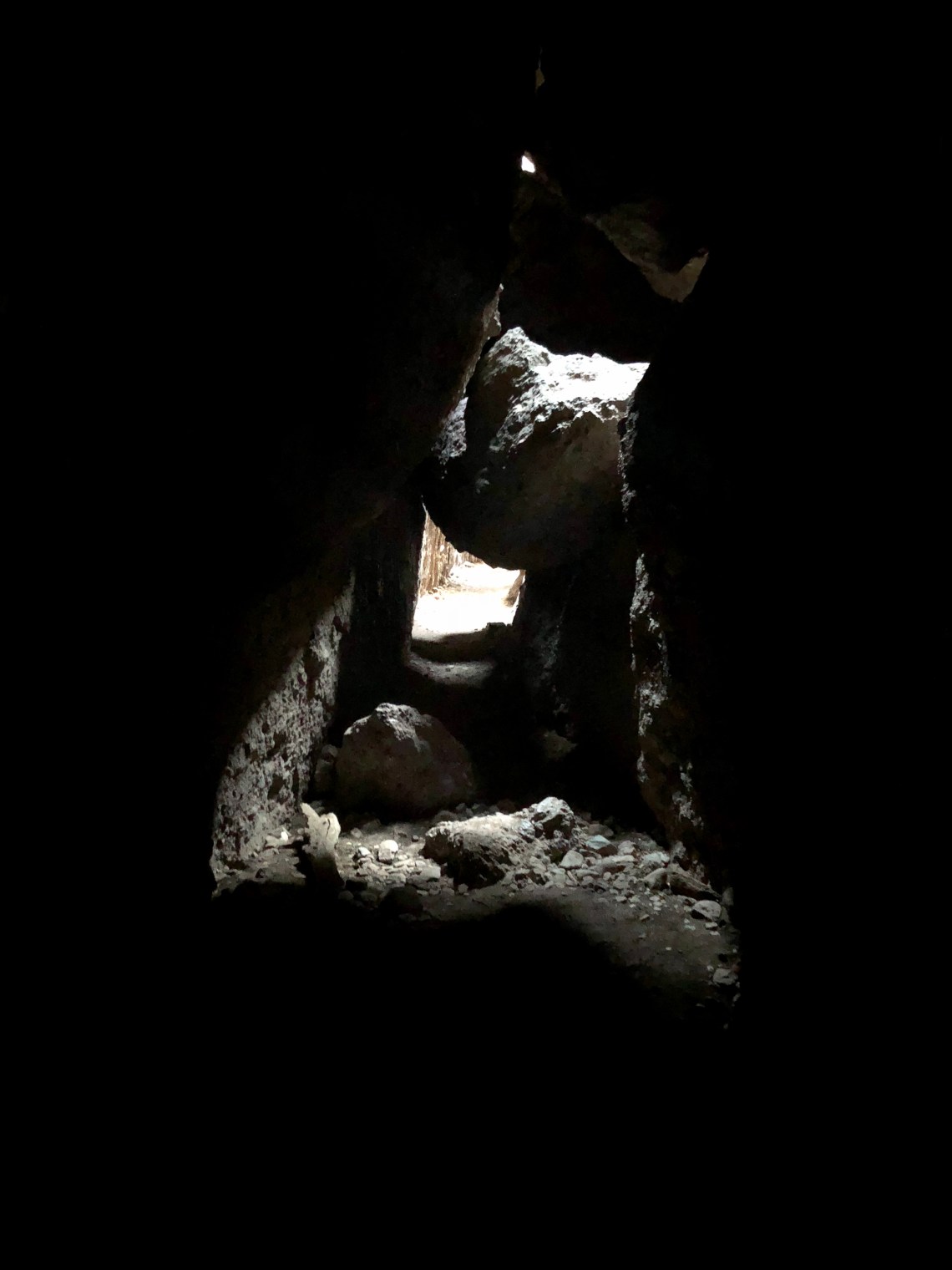
Old Pinnacles Trail is a white-grey cinder and rock path, bordered by grey pine and an occasional cottonwood near the West Fork Chalone River. Vibrant and slight colored shrubs and wildflowers are everywhere. Chaparral currant, a soft blush of purple. Holly-leaved redberry, from deep red to lime green. Pink and white California buckwheat. Yellow centered Pipestems. Orange wind poppies. It’s a relaxing hike of a few miles before reaching a large metal gate marking the entrance to Balconies Cave. It stands open. Daring me to enter. I walk in and immediately regret not having a headlamp. For the next half mile I crawl over, underneath and around leaning boulders the size of cars. Mostly in the dark.


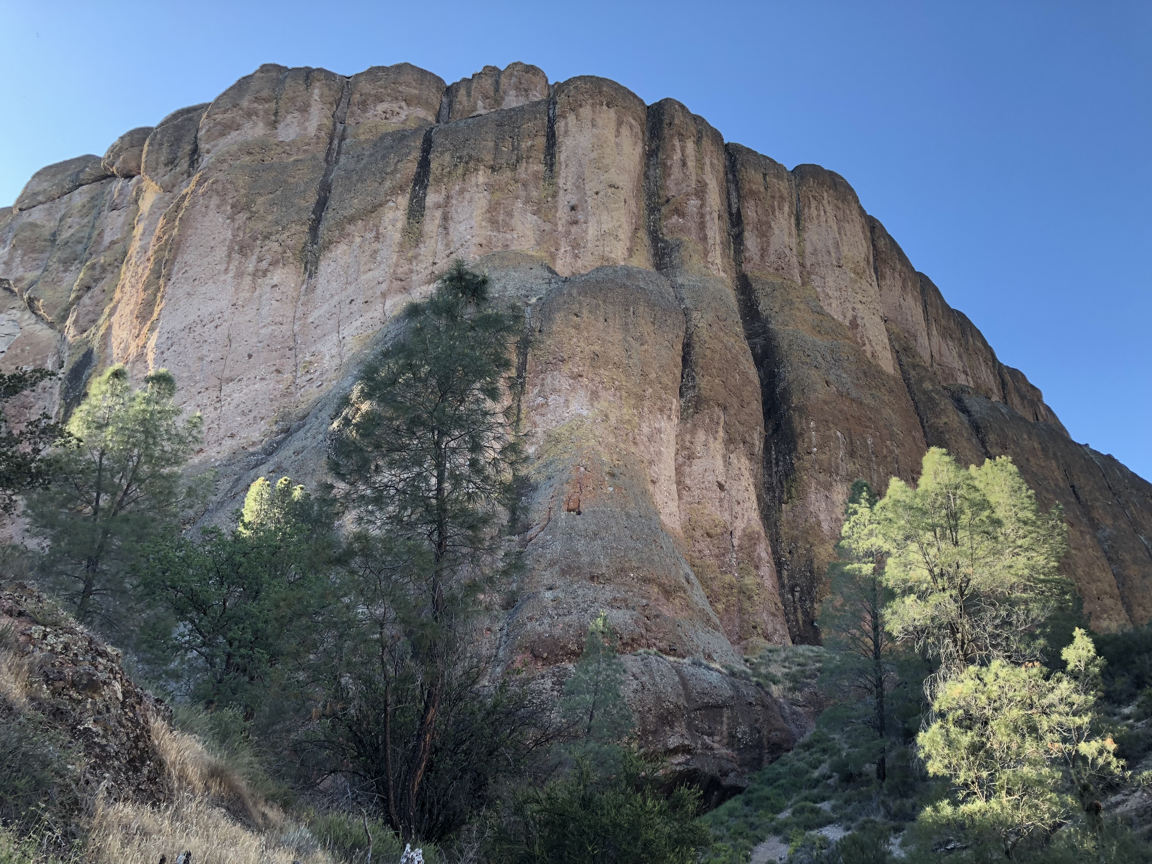
A short distance from the cave’s end, Balconies Cliffs Trail begins to wind upward. Hugging The Balconies, igneous rock pushed into water streaked columns, the narrow trail turns to provide perfect views of the imposing Machete Ridge. After passing rock formations Osiris, Smiling Simian and Toogs, the trail begins a slow descent. Chipmunks, better known as miniature bears, scramble through the brush and pose on rocks just long enough for me to raise my camera, before giggling and scurrying away.
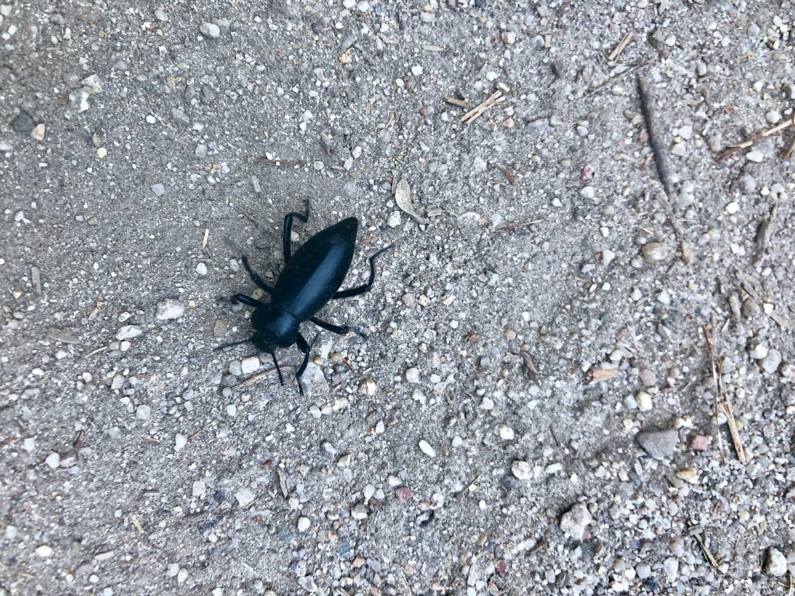
As the trail begins to flatten, I decide to stop for a sip of water. But before I can take off my backpack, something flies directly into my eye. I swear I could hear it hit my eyeball. Splat! Reflexively my eye clamps shut and I begin to rub my eyelid. This was a bad idea. As I slowly opened my eye, which is now shedding tears like a faucet, a large black spot dominates my left eye. I pull down my eyelid and roll my eye up and down, just as I was taught by my dad. “Loosens up whatever is in there,” he would say. At this moment, as my eye begins to burn, I realize my dad’s theory may have been flawed.
Grabbing my water bottle, I hold my eyelid open and begin to pour water directly onto my eye. Still a black spot and burning. More water. After a couple of choice swear words – okay, more than a couple – I reach up and gently begin to probe my eye with my finger. Something sticks and I pull it away from my eye. A black fly. A black fly, obviously with no sense of direction. A few more rinses. I hold my handkerchief directly against my eye and keep hiking. When I finally reach my van, 3 or 4 miles later, it’s still watering and burning, but I can keep my eye open. I’m hoping to have Peter Parker kind of powers when I wake up.