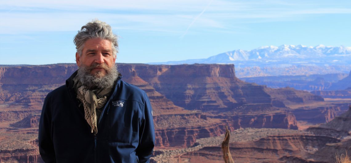

I think, at a child’s birth, if a mother could ask a fairy godmother to endow it with the most useful gift, that gift should be curiosity – Eleanor Roosevelt
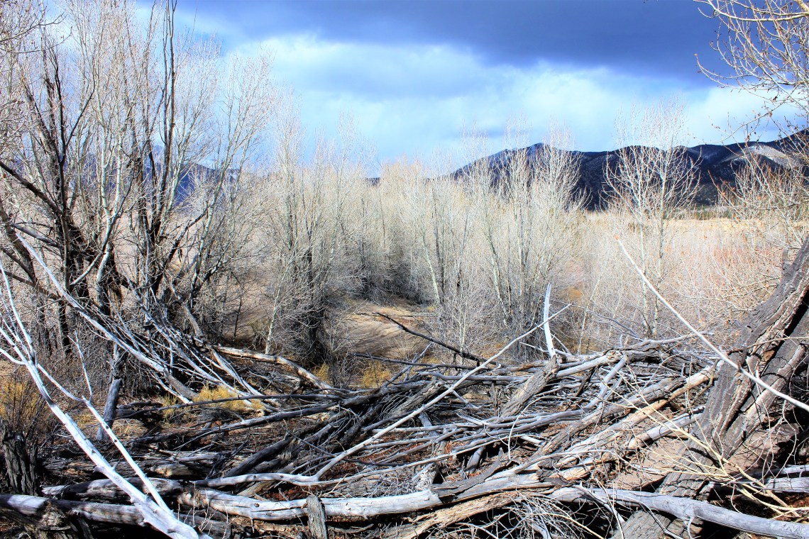
To drive between Montrose and Parlin, Colorado on Route 50 is to experience the grand diversity of magnificent high country landscapes. Two narrow lanes of ever curving pavement, twist through deep canyon passes and broad open range fed by the Gunnison River. Towering plateaus hold the horizon – great green forests tucked beneath, bleeding into tall yellow grasses. Snow rests on evergreen and rock, sun glinting from odd angles as each turn dictates. Old shorelines of Blue Mesa Reservoir, in shaded rings of dusty brown, sit in stark contrast to frozen edged blue water. Tenderfoot Mountain, with her prehistoric treasures safely excavated, presides over a merging of the Gunnison and Tomichi River, before Route 17 turns sharply south toward one of the largest high desert valleys in the world.
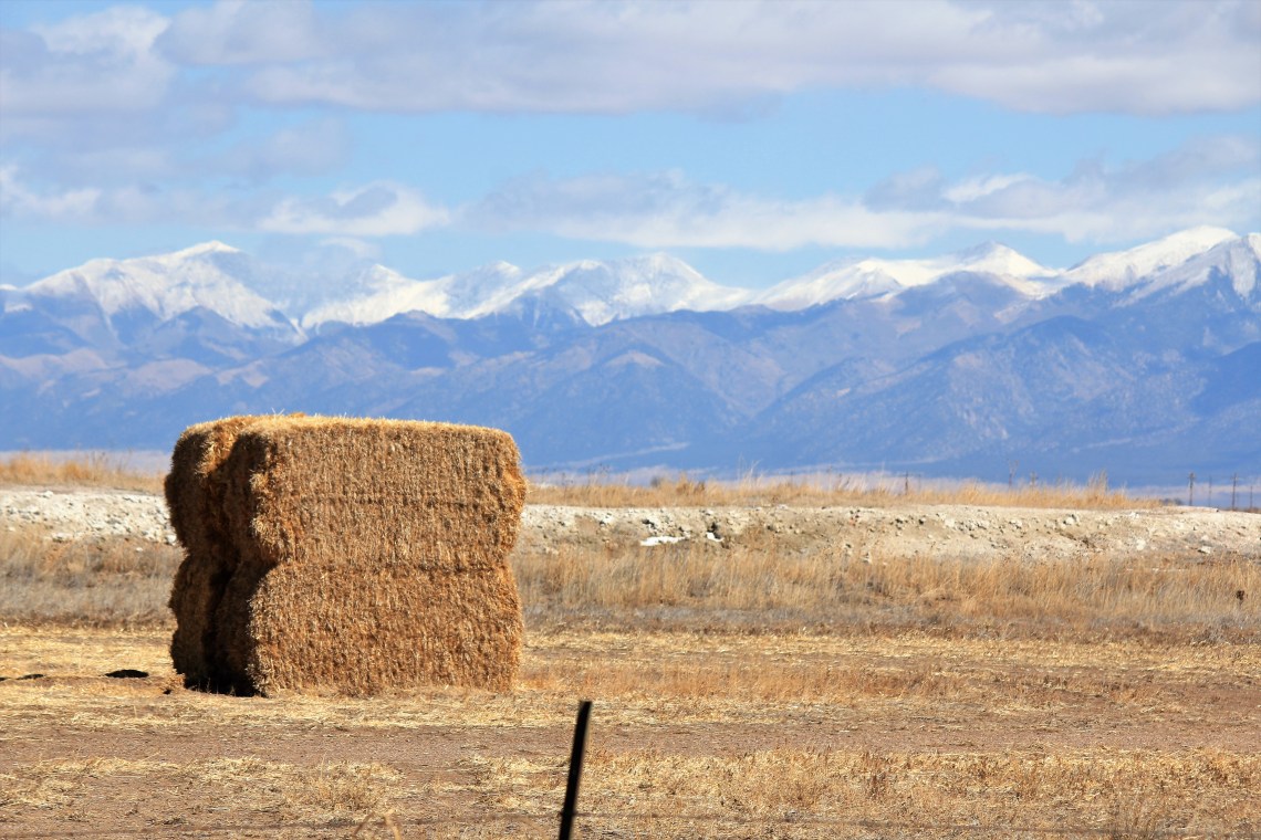
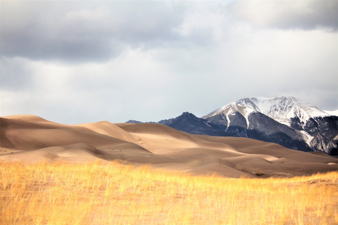
Between the Sangre de Cristo mountain range in the east and the San Juan’s to the west, San Luis Valley sits on top of the Rio Grande Rift, a boastful 125 miles long and 65 miles wide. At 7,000 feet, the elevated valley spreads uninterrupted, bisected only by a carpenter laid straight line road, before crashing into snow capped, white ribboned mountains. Open space of tended winter fields as far as the eye can see. Golden bales of perfectly bound hay. Tiny homes, scattered and long since abandoned to screeching ravens rest on the sweeping flat amber landscape. In the distance, smooth suede hills cower beneath blue-green mountains. Waves of ever changing sand, pushed to unseen heights by warring winds.

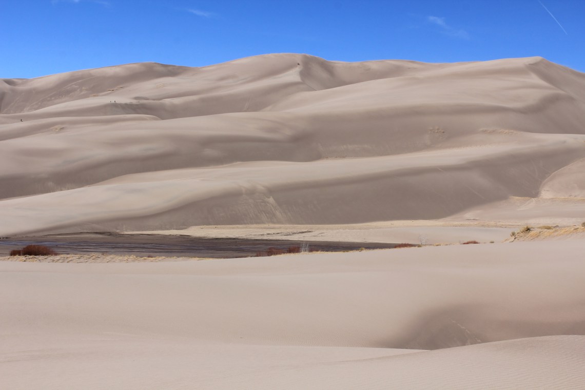
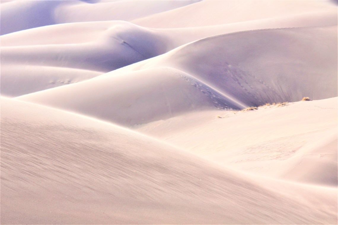
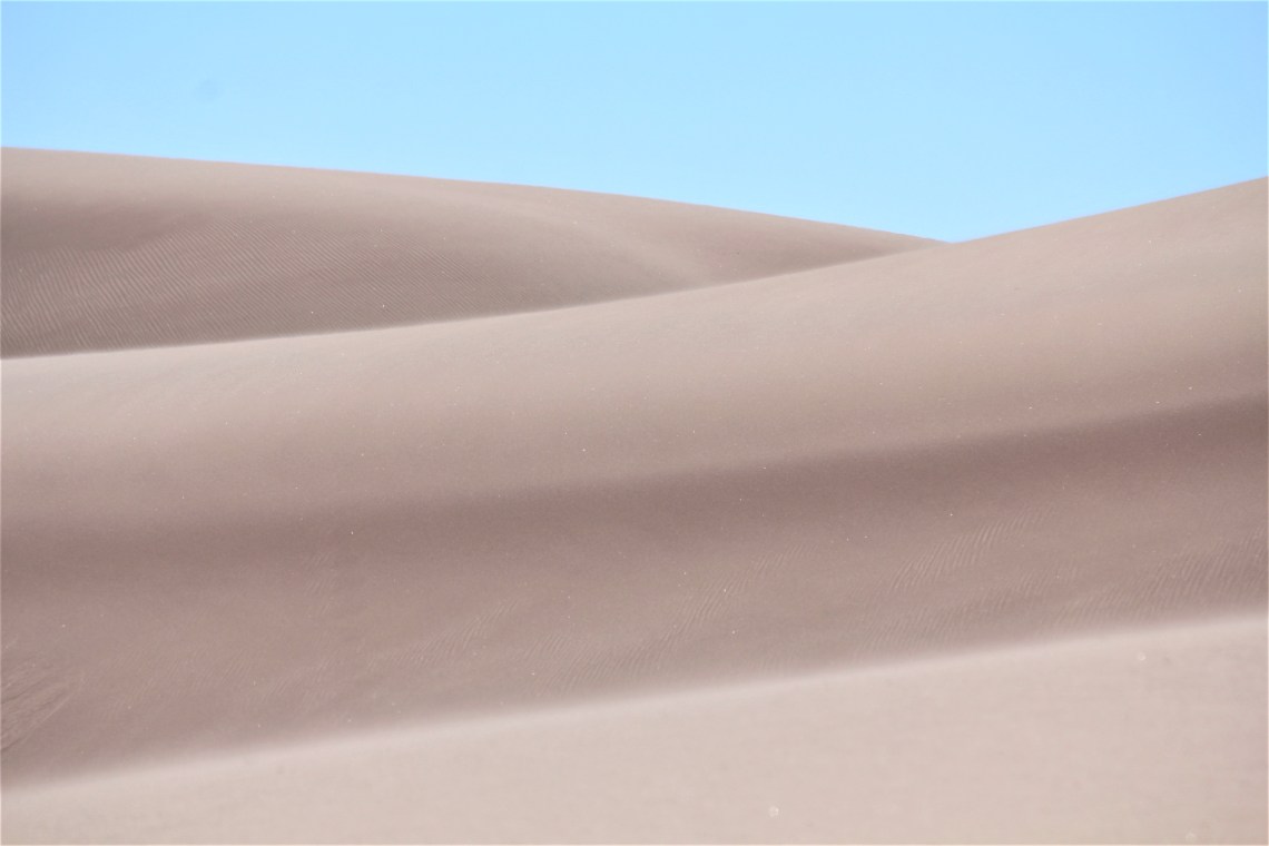
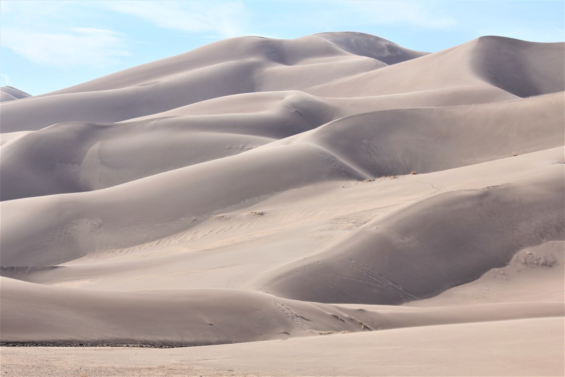
Driving into Great Sands National Park can be a disorienting experience. Hallucinatory experience may be more accurate. The road is pin straight, so everything slowly gains depth and weight as you approach. I’ve encountered this many times with mountains or large bodies of water. But in those cases your brain has a multitude of reference points. You know what a mountain looks like from a distance and can process how it will expand as you draw closer. Same reference points for water. It all falls apart for sand. There are few psychological reference points when something is unique – and the Great Sand Dunes are certainly unique. As you get closer, your brain has a difficult time processing that the smooth, undulating mountains ahead are made of sand. Trust me, it takes a while to realize what you are looking at. And even then you begin to doubt your senses.

The various juxtapositions of flat yellow grasslands colliding with thousands of years of sand pushed against mountains, is so odd at first sight as to make you simply stand still and stare. How, flashes through your mind and then settles in. How indeed. I’m standing on a vast high desert valley, surrounded by mountains, with no evidence of sand except the 700 foot creamy peaks directly in front of me. I can’t be the only one thinking this. Time to visit the ranger station.
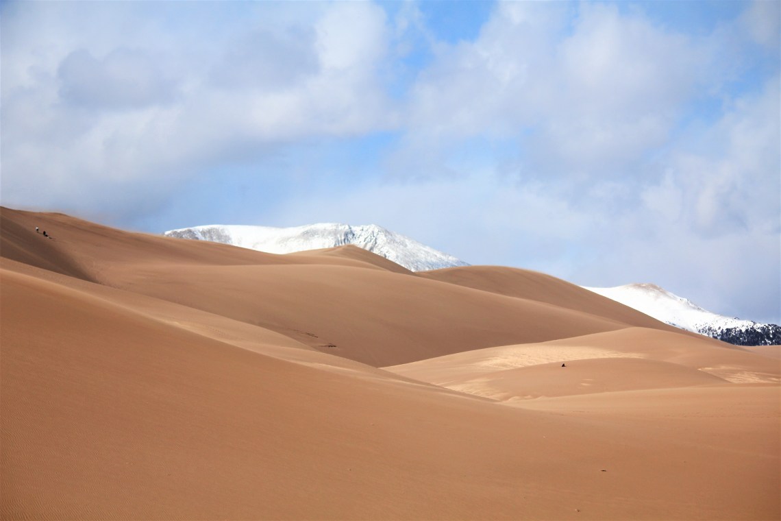
Paraphrasing the geological response from ranger Dan. At one point deep lakes spread across the valley, left behind by receding glaciers. When the lakes dried, they left behind a layer of sediment, called sand sheets. Predominant southwest winds push sediment toward a low curve in the Sangre de Cristo Mountains. Wind also funnels toward three mountain passes – Mosca, Medano, and Music – and the sand accumulates in a natural pocket against the mountains. Conversely, during storms the winds blows over the mountains and back toward the valley. These opposing wind directions cause the dunes to grow vertically and my head to explode. NOTE: There will be a quiz at the end of this piece.
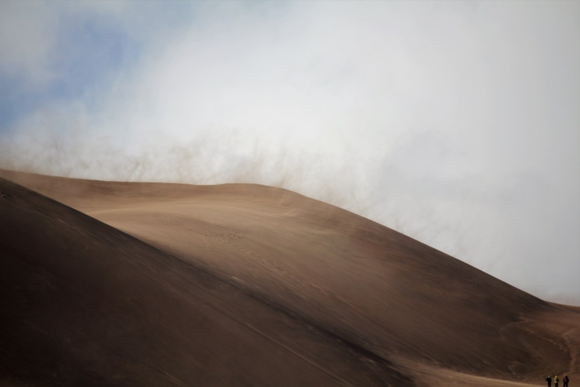
When you first walk out onto the dunes, it takes a moment to realize that the tiny specs on the horizon, or in the middle of a distant dune are people. That small dot of color against a dazzling blue sky is a person. Immediately you grapple with perspective – but slowly you realize the scale of the dunes. Having walked along the ridge of dunes in Death Valley a few months ago, the difference in size, the sheer volume of sand deposited, is breathtaking. I start chugging up the first few dunes and quickly remember how much I dislike hiking in sand. Snow, sandstone, hard rock, mud – fine. With sand it’s one step forward, slide a bit. Two steps forward, sink a bit. I suppose there are those that enjoy hiking in sand. There are those that like putting their finger in a light socket. I love where the hikes lead and what I discover along the way, so I will always move forward. But the physical act of hiking in sand is one I can leave behind and never look back. Much like the time I put my finger in a light socket.

There are no trails on the dunes. Yet 99% of the people hiking the dunes are following a similar path. One that leads from the visitors center and straight up the dunes. I find this odd. The dunes are several miles wide – yet if you were to observe the stream of hikers from afar, instantly you might believe you were looking at a line of ants climbing a sizable hill. A few move to the left or right. But for the most part, they climb the same few ridges, exploring the same pockets, waves and vantage points. I have no explanation for this, other than the shortest distance between two points is a straight line theory is well ingrained into the hiking public. I adhere to that theory much of the time myself. In this environment however, it just strikes me as odd. So I turned to the left and began hiking horizontally.
Medano Pass Primitive Road is not aptly named. The term ‘Road’ is a stretch. It’s two tracks of rocky, deep holed torture for anything less that a small tank or two feet. As I walked down the road, two women on horseback emerged from the brush. “Good afternoon.” Good afternoon ladies. A fine day for riding. “Yes it is. Every day is a fine day for riding.” I smiled. I suppose it is. Have a good ride. “Thank you. Enjoy your hike.” They passed and I continued on a few yards before stopping. Hmmmm. I wonder where the horse trail leads. I turned, looking for the trail that had brought them out of the brush. Found it and started down a path framed by narrow leafed cottonwoods and overgrown saltbush. Fifteen minutes later I was walking up pale brown dunes, looking down at broad leaf cattail and a wide broken stream.
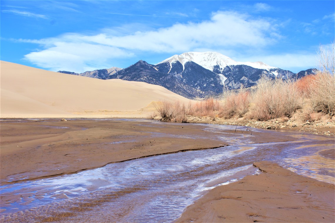
Medano and Sand Creek run along the base of Great Sand Dunes. During winter months, the steams move underground, laying almost still, waiting for the Sangre de Cristos to release her snow. In spring, cool water begins to flow across the sand, cutting small grooves into the muddy shallows. The valley’s lifeblood, they support a diverse plant and animal ecosystem on the edge of a desert. Developing a strong current in the summer, the water also recycles sand, moving it from the mountains along the valley floor. As I hiked along Medano Creek, the water was hardly a trickle in most places. Pockets of water formed around the deep imprints left by the weight of horse and rider. I could see the outline of the creek – where it would be in a few months – but had no trouble wading through and across the one or two inches of water. Closer to the mountains the water quickened and if you bent down you could hear its movement as it crept across the sand.
I had confirmed with ranger Dan that even though it had been a mild winter, the campgrounds inside the park were still closed. “Are you self contained?” I am. While answering I was hoping that we were talking about the same thing. “When you leave the park, between mile markers 20 and 21, there are a few….places. Small cutouts just off the road in a field. No one will bother you there. Except the coyotes.” He laughed a short laugh. “Complete darkness.” Perfect. I thanked him and walked back to the van. The sun was beginning to set as I drove out of the park on Route 150. “Except the coyotes.” Thanks ranger Dan.
Every once in a while you get lucky. Every so often you get a tip that works out. Dan was right. About 20 minutes outside the park, I found a small spot in an open field and backed in. I was surrounded by sweeping yellow grass and granite edged mountains. Far enough off the road that if a car passed by during the night – doubtful – I was invisible. As the evening sky began to show off, I had a distant memory of sitting in the back of a station wagon, looking up at the drive-in screen. Hot dogs prancing across a square white screen, followed by a dancing beverage with a cane. There were probably eight of us crammed into the Buick Vista Cruiser. PJ’s and popcorn. Tonight it was just me and the sky. Far above the valley, violet clouds pranced across the sky, fuzzy and scarlet streaked. Blues softly melded into deep ink and danced above a scorched yellow horizon. It was a majestic display. Perhaps the grandest sky I have ever seen.


Having spent eight hours hiking in sand the previous day, I was determined to find a few trails of hard earth. Montville Nature Trail is a short loop that affords views of the dunes from a distance and also details the subalpine environment of the Sangre de Cristos lower fringes. Colorado blue spruce and Englemann line the path as it merges with Wellington Ditch Trail – a fairly level path winding through open meadows on its way to Pinion Flats. Ponderosa pines, peeled for food or medicine by American Indian tribes, sit along the trail – lending the smell of vanilla to the forest. In a sunken meadow, the long abandoned cabin of homesteaders Frank and Virginia Wellington, snuggles into the trees. From this vantage point I can clearly see a line of people climbing the dunes – small specs seemingly caught in a still life painting. It’s sunny and 65 degrees. I find my way back to the original trail, turn into Mosca Pass and follow the creek up into woods.


NOTE: For more information on Great Sand Dunes National Park and all the National Parks and to help with trip planning, download the free Chimani app to your smart phone to easily navigate your way around the park, with or without cell phone service.
